 |
BALDOCK CIRCULAR 2015 - October - 04 |
|

Our Walk
Our Sunday IVC walk of about 12⅔ miles (20⅓ Km) was led by Simon. True to his word, this attractive but not so well known area seemed to ooze English history through every pore. It was an anti-clockwise circular walk across the gently undulating North Hertfordshire landscape. Good arable country with historic villages sunk for protection into the hollows.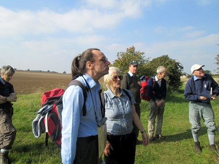
On the first part of our walk, some of us pose for a group photograph
- well, actually we are looking at a rather noisy helicopter!
Starting from Baldock Station we struck roughly north, and after about five miles we reached our lunch stop at historic Ashwell's "Rose & Crown". The source of the Cam is here, but this time its precise location eluded us! We returned via the site of the long lost village of Caldecote, whose mediaeval church and manor house still remain as testimony to busier days. The small historical village of Newnham was next on our way. Finally, the view of Baldock from the exposed heights above the town, and the subsequent descent to Baldock Station, marked the end to an excellent day in the Great Outdoors.
So here is what this page has in store for you. Even if you were not able to join us, here's your chance to find out how we enjoyed our nice early autumn Sunday IVC event.
- Getting to Baldock
- Our Morning Walk to Ashwell
- Lunchtime in Ashwell
- Onwards to Caldecote and Newnham
- Return to Baldock
- Some Facts and Figures for Fun
- Thank You All for a Nice IVC Day Out!
- Please Read Me
Enjoy your browse!
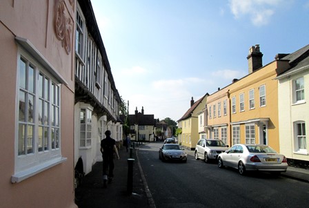
Coming to Baldock
In well under an hour we are transported from the wilds of London to the wilds of the countryside. As an "early bird" in Baldock, I nosed around "downtown" Baldock, with its time-honoured buildings and interesting inn signs. Food for my camera!
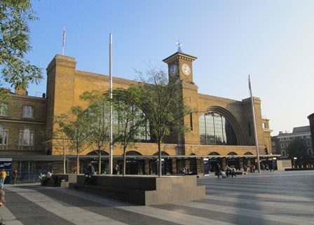
King's Cross Station, Lewis Cubitt's famous 1852 masterpiece,
is the gateway to the north - and today that includes Baldock.
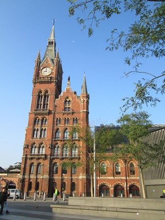
One of the two towers of the Saint Pancras Hotel looks across to King's Cross,
as it has done since 1873.
Baldock is less than an hour out of town - a comfortable high-speed run.
Baldock Station (in the far background) may date back to 1850, but subsequent modifications have left it bereft of any elegance it once may have had.
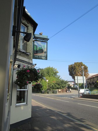
However, the nearby "Engine" pub harks back to ...
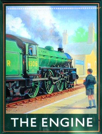
... the age of steam and "train spotting".

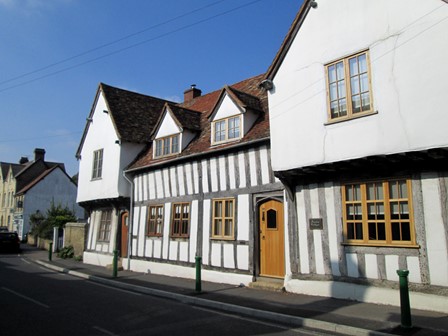
Towards the centre of Baldock there is this sprawling edifice, dating back to 1540.
Over four and a half centuries of magnificent sprawl.
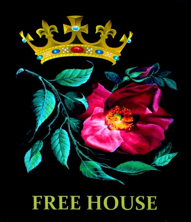
Baldock's "Rose and Crown" has a nice sign ...
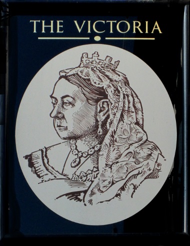
... and "The Victoria" a very dignified sign. There are at least three further hostelries in close proximity, but with inn signs of lesser splendour and interest. Incidentally, the multiplicity of hostelries seems to suggest that Baldockians are not averse to a good night out.
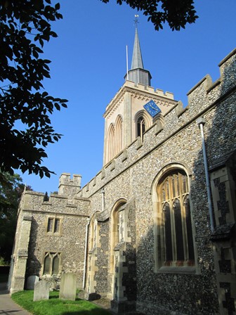
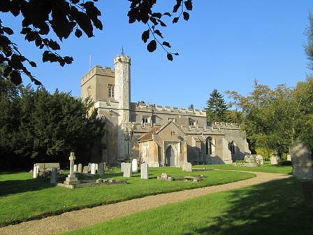
Baldock's thirteenth century Parish Church of St. Mary the Virgin
presides timelessly over the ever changing landscape around it.
I'm sure there's a lot to see inside the church, but today it's Sunday
and so I don't really wish to disturb the worshippers within.
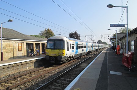
It's back to the present - to Baldock Station - to await today's main IVC walking contingent.
Our Morning Walk to Ashwell
In the morning, the first "leg" of our walk takes us across open country to Ashwell with its famous old buildings. It's about five miles, but there is still time to include lunch at Ashwell's (not Baldock's!) "Rose and Crown". Maps and footpaths don't always seem to coincide, but we make it today with true IVC hiking experience and determination!
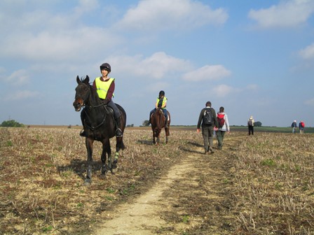
We head north out of Baldock, straight onto the undulating landscape that characterises North Hertfordshire - a landscape almost designed for horse riders!
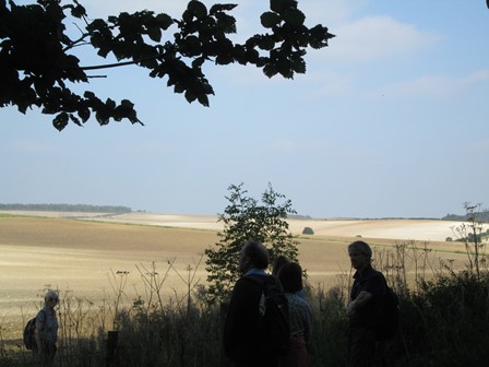
As we leave Bygrave wood, some of us are silhouetted against the fertile rich arable farmland.
We stop to seek inspiration from our maps, although the object of our intense interest at the moment is a rather noisy flying machine!
Lunchtime in Ashwell
At the "Rose and Crown" we enjoy good Sunday country fare. After our lunch, there is still time to soak up some of the history emanating from the traditional buildings that are the hallmark of Ashwell. The outside of the church is interesting, in contrast to its rather plain interior. But overall, as we find, Ashwell scores well in matters architectural.
Ashwell is full of traditional buildings, some going back to mediaeval times.
These Tudor houses welcome us ...
... as we proceed along the High Street ...
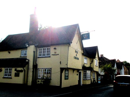
... to the "Rose & Crown", our lunch stop at the end the said thoroughfare.
It is largely cloudless today, and the sun is determined to tell us that on this picture!
Perhaps another good reason is that, on 3rd March 2015,
the Rose & Crown's Food Hygiene Rating was 5 out of 5!
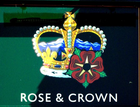
The inn sign is attractive but not (at least in my humble opinion) as artistically attractive (in terms of picture and sign-writing) as that of Baldock's "Rose and Crown" sign.
The rose is really meant to be pink, because Henry VII, in 1485, said that it was time for
the Houses of Lancaster (red rose) and Yorkshire (white rose) to stop fighting!
So the rose - the Tudor Rose - was henceforth to be pink!
Indeed, the ditty "They're pulling down the Rose and Crown"
seems to indicate the popularity of this pub name.
Some post-prandial exploration of the oodles of history in which Ashwell is enveloped is definitely in order. From the High Street, a small lane of traditional houses leads to ...
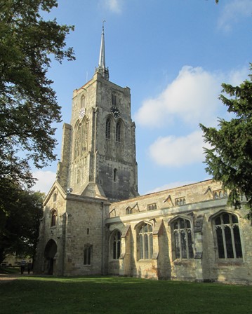
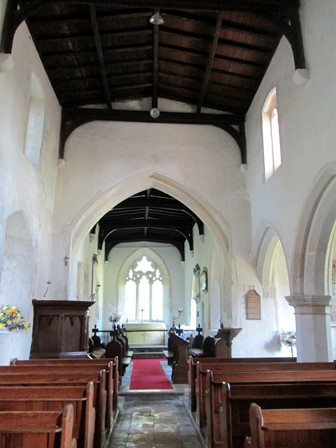
... the 14th Century Parish Church of Saint Mary. In 2013, this church shot to national prominence in the context of the row over the quarter hourly chiming of its clock - noise pollution, some did say.
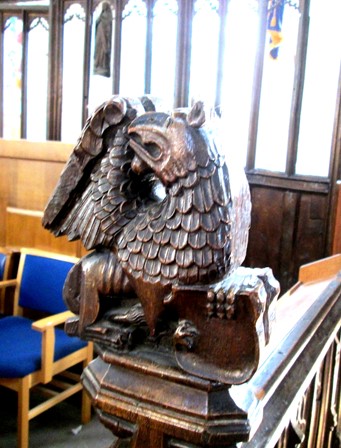
For a church of this age, there are remarkably few monuments to be seen inside. Admittedly, the altar area is being restored, but the £1 entrance to the book fair being held in the church somehow doesn't seem to be in the appropriate spirit of things! £1 for the book sale and not to see the church! Anyway, I catch this shot of a wooden "end of bench" carving of a dragon on one side of the aisle, ...
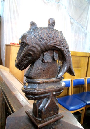
... and of a fish on the other side. Probably not that old, but quite interesting. However, there is a paucity of monuments, other than some memorial stone slabs set into the floor of the main aisle.
Onwards to Caldecote and Newnham
Our afternoon is an historical treat with Caldecote and Newnham both featuring on our walk. Both places offer interesting insights into the social structure of rural England in times past. Indeed, one of the merits of a country walk is that one can often learn a lot about these things while at the same enjoying good and often much needed exercise.
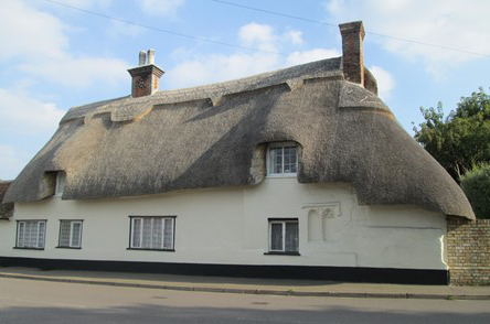
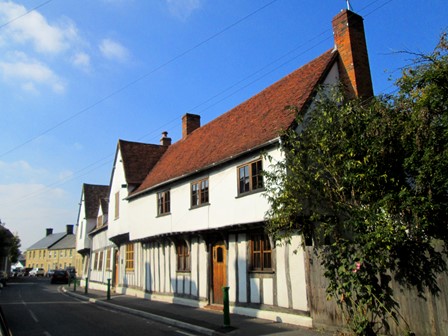
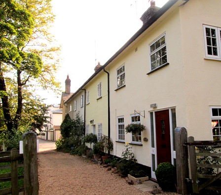
This "half-thatched" house splendidly stands guard as we "leave town".
As we rise to higher things, Ashwell bids us goodbye.
The weather is still quite warm for early autumn, but mild enough for comfortable walking.
We picked a good day with good visibility!
And so to Caldecote. The village is no more and the church of St Mary Magdalene (14th and 15th centuries) has been adopted by "The Friends of Friendless Churches".
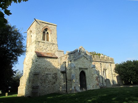
A bit more of England's history has been saved from dereliction.
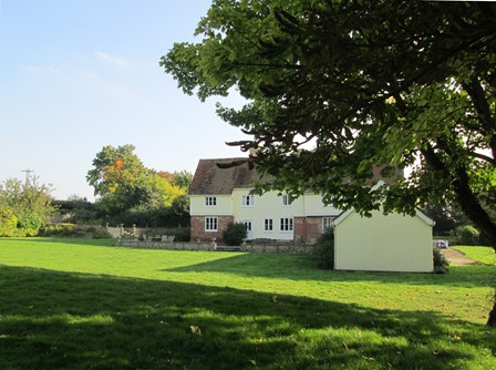
In many villages, the local squire had his residence next to the church - as in Caldecote. This proximity emphasised the mediaeval axis of local power - between them the church (spiritual) and the squire (temporal) made sure that the locals did not step out of line. Today's social order, even in the countryside, has seen many changes!
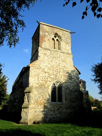
Less than a mile away - roughly to the south - is the small village (almost a hamlet) of
Newnham with its time-honoured parish church dedicated to Saint Vincent.
Time seems to stand still in and around churches like this one, but ...
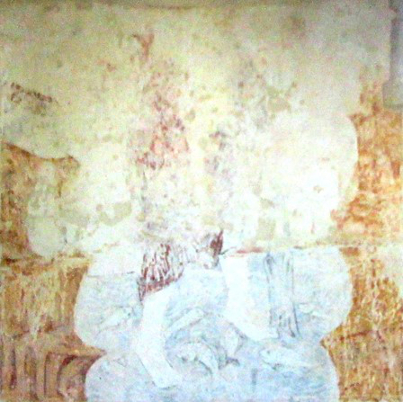
... 1963 was an interesting year for Newnham, for it was then that several mediaeval murals were discovered, hidden beneath the whitewash. Church murals were intended to educate the illiterate masses of those distant times in matters religious. This mural, according to the experts, depicts Saint Christopher carrying Christ across the river. Unfortunately, Oliver Cromwell and time have not been kind to this particular example of mediaeval artistic endeavour.
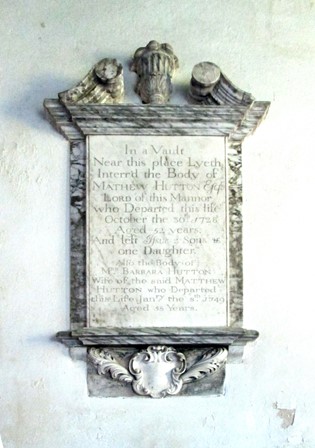
Village churches are often a splendid repository of local history. Monuments to those important at the time and now long forgotten, often grace the church walls. At one time in Newnham, this person was so important that he had his monument inside the church and not outside in the graveyard. Chiselled in stone on this monument is the text, which starts off:
In a vault
near this place Lyeth
Interr'd the Body of
MATHEW HUTTON Esq
Lord of this Mannor
who Departed this life
October the 30th 1728
Aged 52 years.
[... etc ...]
The spelling and capitals are intentional and don't conform to modern English! However, we can read a lot into the nature of the times before the industrial revolution took off in earnest.
Nearing Baldock
More open country awaits on the return to, and descent into, Baldock. It is nice to avoid the busy A 507 and the roar of the A1(M), even though footpath signs keep pointing in their direction. After all, on a country walk one tries to avoid the exhaust and noise pollution engendered by modern traffic. Avoidance of pollution is one of the pleasures of a country walk! On the return "leg", there is a lonely half-hidden trig point pointing to the demise of the 1930s style of producing OS maps. A balloon wanders slowly through the afternoon air. Baldock Station is reached comfortably by about five thirty, well before night fall. No need to hurry on a fine and rare autumn day like this!
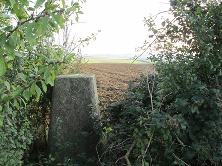
This is the 96 metre trig point. It's surrounded by bushes, indicating that this 1930s approach to map making has yielded to the effectiveness of aerial photography supported by computer power.
However, although they are now retired from active service, trig points
still serve the walker as useful and not too intrusive landmarks.
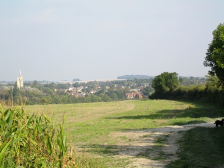
The view is south-facing, towards Baldock in the valley.
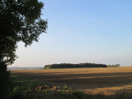
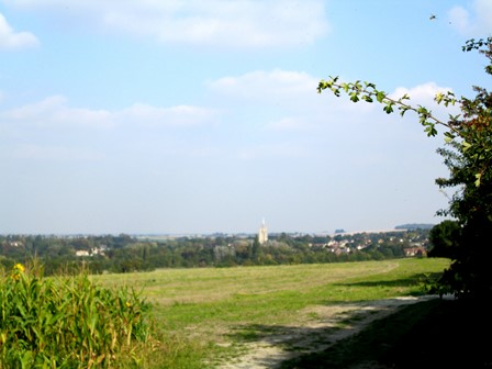
Here's a look north towards the gently undulating farmland of North Hertfordshire.
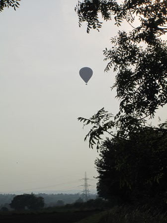
The afternoon will soon give way to early evening, and this balloon
is about to make a gradual descent ...
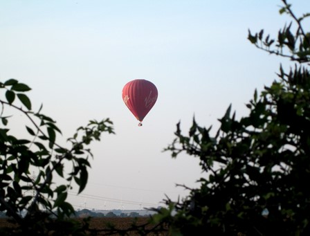
... carefully avoiding the power lines!
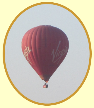
This, it appears, is not your usual Virgin flight.
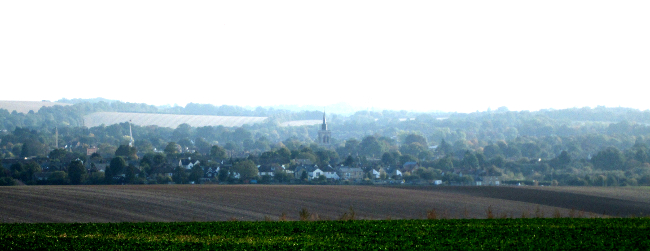
Baldock beckons, with the spire of its mediaeval parish church taking centre-stage in this view.
It's been a good day, filled with the warm sunshine of early autumn.
Some Facts and Figures for Fun
This anti-clockwise circular walk of about 12⅔ miles (20⅓ Km) may not reach the dizzy heights of walks in the Chilterns, but there are sufficient ups and downs to make sure one does not forgo good exercise for legs and feet! Now prepare ye for some plots and graphs. Not too overwhelming, but hopefully quite interesting! You will see here:
- An Outline Map of Our Walk
- Height Profile of Our Walk
- Some Facts and Figures
- Average Rising and Falling Gradients
Outline Map of Our Walk
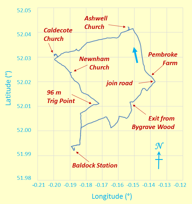
Outline Map of Our Anti-Clockwise Circular Walk
The minus signs for the longitude angles indicate "degrees west of Greenwich". The map grid scales translate to 0.6844 Km per 0.01° longitude and 1.1119 Km per 0.01° latitude, all when using 6371.0 Km as the volumetric mean radius of the earth - derived from the WGS84 standard! Interestingly, for last Sunday's (September 27) IVC Godalming Circular walk, the longitude scale is already marginally greater at 0.6972 Km per 0.01° longitude - really as expected!
Height Profile of Our Walk
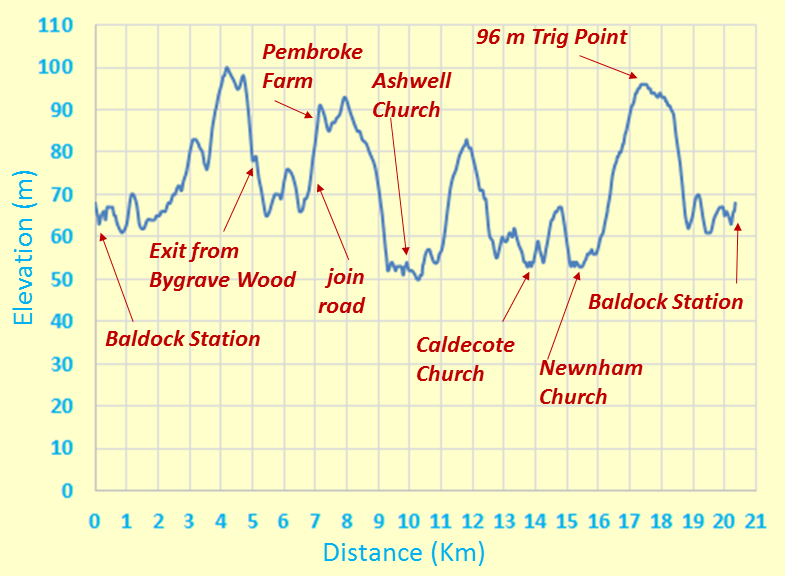
Height Profile
This height profile emphasises that we did some climbing and descending throughout the day - not too demanding. All quite leisurely! Interestingly, Ashwell, Caldecote and Newnham all lie below the level of the railway line. The open country in this part of Hertfordshire is probably quite exposed to the elements, so building settlements in the dips in the landscape may have offered some protection from seriously inclement weather. Our ancestors were savvy!
Some Facts and Figures
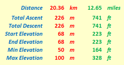
"Walk facts and figures"
Here are some "vital statistics" in metric and imperial units. Of course, the total ascent (here 226 m) usually exceeds the difference between maximum and minimum elevations (here (100 - 50) m or 50 m); I'd suspect things, if the reverse transpired! Start and end elevations are the same at 68 m and total ascent and total descent are also the same at 226 m - as expected, for this walk was circular after all! I can pat myself on the back (hmm, hmm) for doing the hand plotting reasonably accurately!! The total distance, as always measured on a conceptual "flat" plane, is 20.36 Km or 12.65 miles.
Average Rising and Falling Gradients
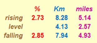
Rising and Falling Gradients
And here, for the numerical fun of it, are the average gradients we overcame on our walk. The rising and falling (negative) gradients are both averaged over the distance given, with level stretches having rises and falls of less than ± ½ metre. By comparison, Hertfordshire County Council recommends that its roads should not have longitudinal gradients of more than 5% and one of the steepest adhesion railways in the world, in Austria, has a maximum gradient of 11.6%. By way of further interest, the clockwise route of the Fairfield Horseshoe in the Lake District has a total distance of 15.62 Km (9.71 miles), with the following calculations: an average rising gradient of 14.66% over 6.589 Km, a level part over 0.345 Km, and an average falling gradient of 11.11% over 8.676 Km. This is seen by many as really quite challenging - but then, when you compare it with our Baldock walk, it can be said that in Hertfordshire we had a more leisurely and less demanding aim compared with Lakeland challenges!
Thank You All for a Nice IVC Day Out!
Thank you Simon for suggesting and leading this walk. What you said about the rich history of this area certainly rang true. History seemed to ooze out of every crack in the landscape. An area not too well known, but well worth visiting! Thank you all for making this a good IVC day out. Thank you to the weather gods for bringing sunny weather - warm but not too warm weather - characteristic of early autumn. Our Indian Summer ruled OK!
Eric Scharf
Original: 2015-10-06 @13:33
SAGAX REX HANC RETIS ORBIS PAGINAM PINXIT ANNO MMXV.
© Eric Scharf 2015