 |
BORO' GREEN & EAST MALLING 18th September 2016 |
|
| ARRIVE BORO'GRN OLD SOAR FOREST OFFHAM CHURCH E.MALLING FEATURES THANKS READ ME |
Our Sunday Walk from Borough Green to East Malling
Our Sunday walk today was ably led by Nick who has an encyclopaedic knowledge of walks in the Home Counties and probably also well beyond! Our 13½ mile (21½ Km) "linear" walk took in places steeped in Kentish history. Old Soar Manor was our lunch stop and we enjoyed some refreshments in the historic village of Offham. We ended our walk in the pretty village of East Malling. We had dry weather, not too hot and not too cloudy - in fact, just right for walking.
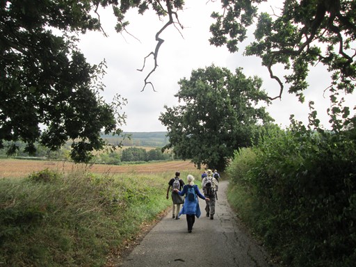
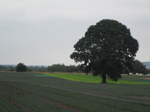
We have left Yopps Green and head for Old Soar Manor.
Summer has certainly not bid us farewell yet.
So here is what these pages have in store for you. Even if you were not able to join us, here's your chance to find out how we enjoyed our fine late Summer Sunday CLOG walk.
- Coming to North Downs Country
- Borough Green
- Old Soar Manor
- Mereworth Woods
- Offham and a Look Around Saint Michael's Church
- East Malling marks the end of our Kentish Sunday walk.
- Features of Our Walk
- Thank You All for a Nice CLOG Day Out!
- Please Read Me - Thank you!
Enjoy your browse!
Coming to North Downs Country
Going by car from Billericay to Swanley reduces the journey time from about 3 hours to about an hour - thanks Ralph for the lift! This was especially welcome because, for Essex people, weekend Rail Engineering Works provide additional challenges for public transport users! Essentially: no car, no walk! The major feature of our route into Kent is the Dartford (Thames) Crossing - in particular the Queen Elizabeth II Bridge with its impressive "cable stayed" construction. We head for Swanley Station, a relic of the thirties - rectangular metal-framed windows and parquet flooring. How "thirties" can you get? We arrange to meet Nick and everyone a few stops down the line at Borough Green and Wrotham Station, where our walk begins.
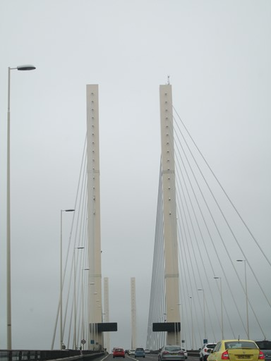
This is the view of the QE II Bridge that the driver sees but of course cannot photograph.
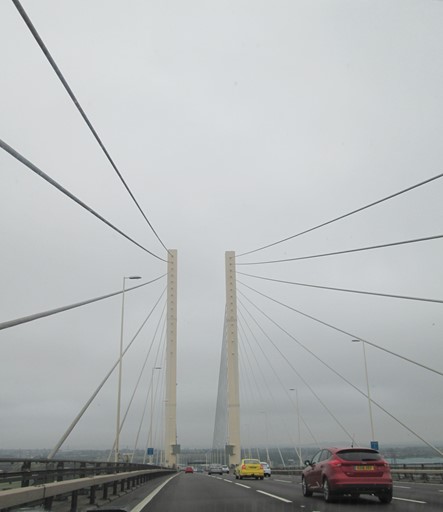
Here is another such view.
Thirties-style Swanley Station is a junction. We park the car and board our train ...

... for the more traditional Victorian-style Borough Green Station where our walk begins.
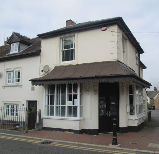
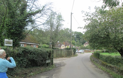
Borough Green
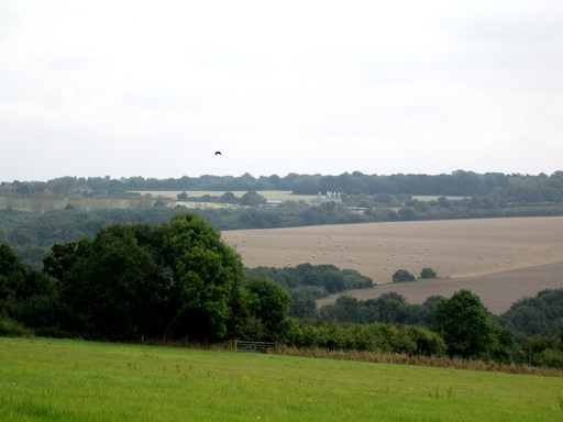
Borough Green is a large village with some old buildings. We head for the south, through an area once associated with ragstone and limestone quarries - ingredients for cement. The quarries have largely given way to new, affluent, houses. We reach the orchards where the apples are almost ready to pick. We then reach the high ground at Yopps Green (strange name!).
This house in Borough Green looks early Victorian ...
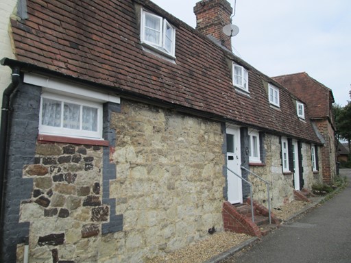
... while these are probably much older.
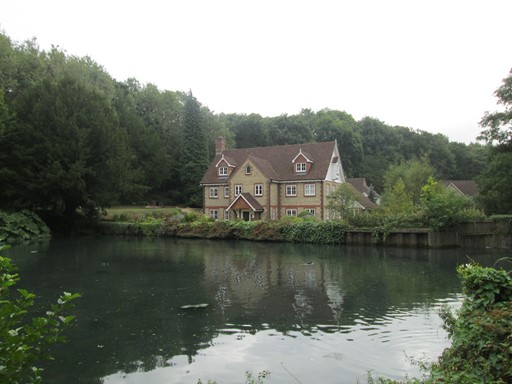
We pass through Basted, once scene of much quarrying. This house on the lake (part of the river Bourne actually) looks nice, but hopefully is not unduly flood-prone.
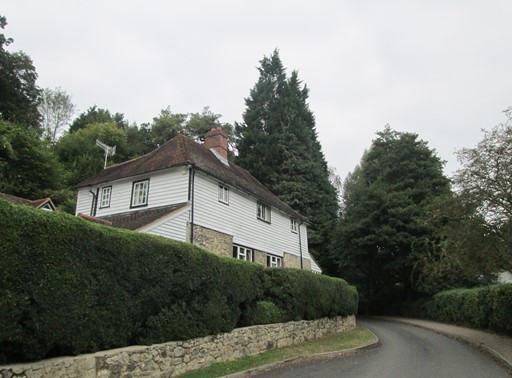
In the quarry area itself there are a number of new-build affluent-looking houses,
like this weather-boarded example
The quarries have given way to detached houses,
perhaps owned by wealthy city workers commuting into London from here.
Here's another example of seemingly prosperous living.
We head out through the apple orchard to Sheet Hill ...
... and enjoy the view towards Igtham. Of course, you're not actually meant to say "Igtham", but to pronounce it as "Item" as the people of Kent do.
As we look towards Igtham we espy some oast houses - which, as you know, used to be used to dry the hops for beer before large scale production kicked in. Oast houses are now generally retired from active service but soldier on as fashionable Kentish country dwellings. Oast houses often come in pairs or as a group of three, but here we have a quintuple of the said buildings!
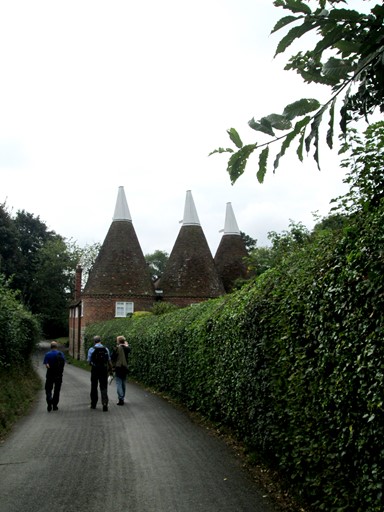
Here in Yopps Green we encounter a mere threesome of the said oast houses.
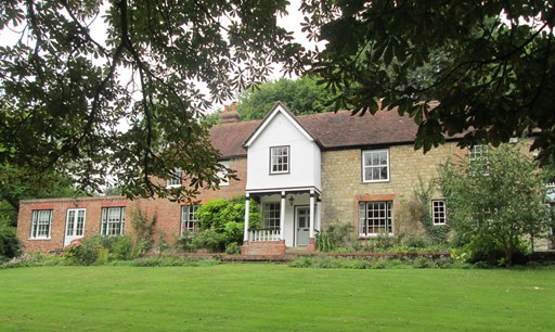
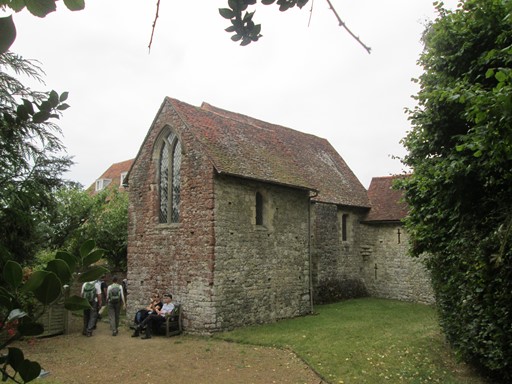
Old Soar Manor
From Yopps Green we do a down-and-up to reach "Old Soar Manor", built as long ago as 1290. Its original owners were the Culpepper family of subsequent herbal fame. Protection against marauders was at the time writ large, so Old Soar Manor was built on a "spike" of high ground as the height profile of our walk indicates. At the Manor, we tarry a while: we play the tourist and we enjoy our respective packed lunches
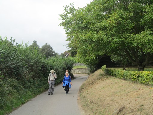
We are enjoying the verdant countryside of very late summer.
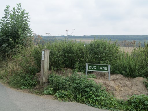
I don't know why "Dux Lane", but "dux" means "leader" or "general" in Latin
and gives us words as seemingly diverse as "duke" and the politically charged "duce".
There's yet more pleasant scenery in store for us before reach the Old Soar Manor.
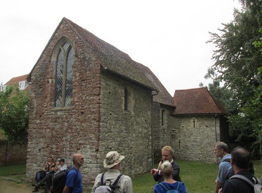
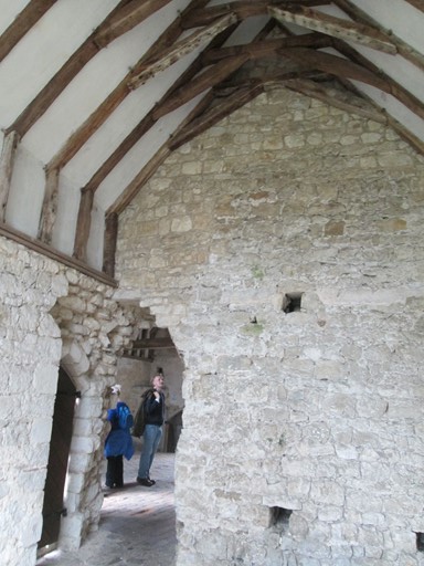
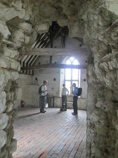
Nick has explained the salient features of the Manor. The Chapel, Solar and Garderobe remain, together with the Undercroft. The Great Hall, sadly, was replaced by the adjoining red-brick house in 1780. We have some time for lunch and for appreciating local history.
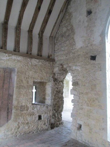
Here's another view of Old Soar Manor. The annex on the right can be entered directly from the Solar (see below). This annex is not particularly photogenic within. However, it was the Garderobe, with simultaneous accommodation for three, so visits to this part of the house were probably quite a social event in mediaeval times. "Garderobe" comes from the French for "garder les robes" meaning "keep the clothes", for moths did not come to this room since
the aromas did not suit their delicate senses.
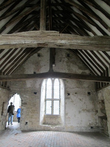
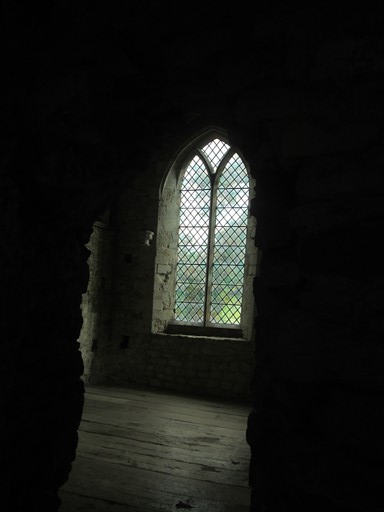
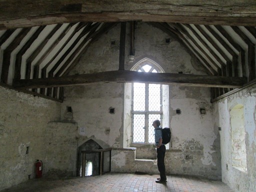
This is the "Solar" purpose of which, as its name and the large (for mediaeval times) window implies, was to catch the sun's rays. Its occupants could bask in light and warmth if the weather allowed.
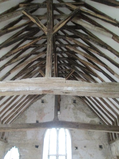
This is the ribbed roof of the Solar. Lots of beams, all assembled with loving mediaeval care.
The chapel seems very large for a house like this. Its size and position in the house suggests that the chapel was deemed to be very important. This is looking from the chapel into the Solar.
A view from the Solar to the chapel.
A darker view from Solar to chapel.
Some features of the Solar get a closer inspection. The anti-clockwise spiral staircase is on the left hand side. Anti-clockwise for defensive purposes in case of attack by outside marauders. Times were tough in days of yore. On the right is the entrance to the famous Garderobe.
A well-known member of our party holds a political speech to a captive audience of two in the Solar. Little could the 13th century occupants of this manor have known that their Solar would echo to a thunderous critique of 21st century politics!
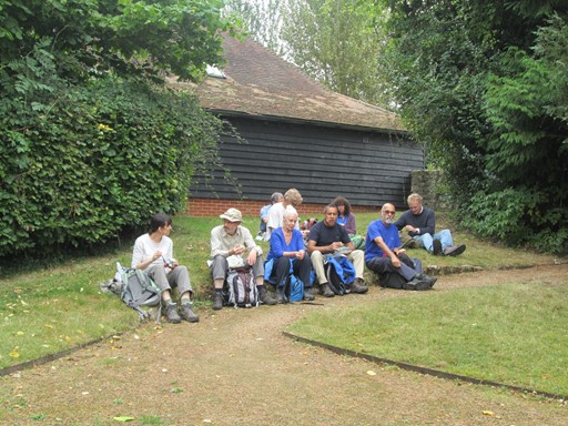
After an immersion in 13th century living,
it's time to have a 21st century picnic on the lawn of the manor house.
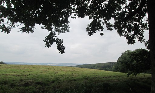
This is looking towards the east and the next stage of our walk: through the Mereworth Woods.
One last look at the Old Soar Manor house.
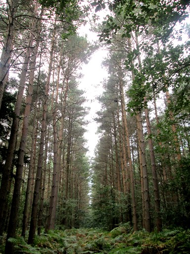
Mereworth Woods
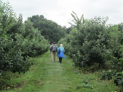
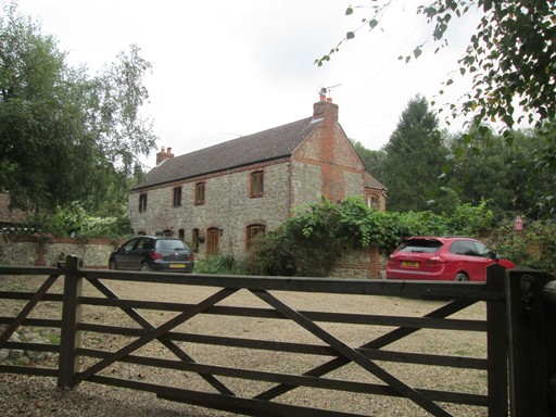
On leaving the manor house, we pass some more apple orchards and wend our way to the highest part of our walk, namely the Mereworth Woods. We pass the Forest Ranger's (Warden's) house with its mini farm and gipsy caravan. In fact, the Ranger's House actually marks the highest point of our walk.
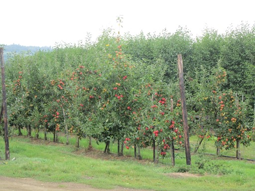
All around us the Kentish apple orchards are decorated like Christmas trees, the red "baubles" looking pretty on the green background. Of course, how much these red "baubles" have been sprayed, or whether they can be regarded as "organic", is another question.
The red "baubles" all need to be packed and dispatched. Where to?
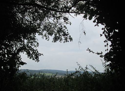
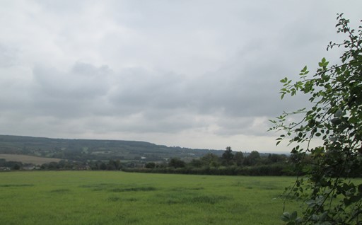
As we seek the higher ground we can look back across the landscape to Igtham.
Don't say "Igtham", say "Item".
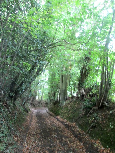
We rise to higher things through this verdant "tree arch" tunnel.
Another view across the landscape towards the North West.
Deep inside Mereworth Woods, the abode of the forest ranger (forest warden) marks the highest geographical point on our Sunday excursion.
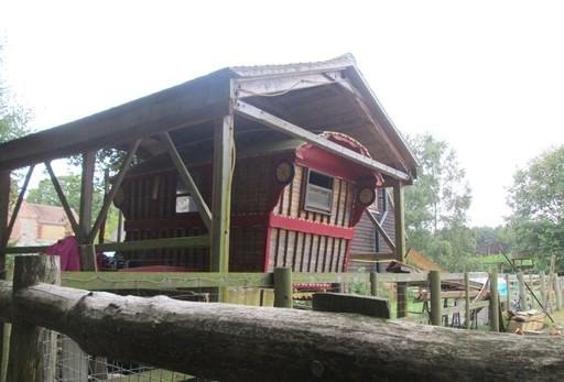
I wonder when the forest ranger has occasion to use this gipsy caravan. It is reminiscent of the one that Toad (he of Toad Hall) used on his first adventure on the open road.
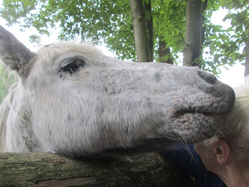
Close encounters of the equine kind.
This may be the chap who pulls the Toad's gipsy caravan.
This part of the forest was planted by the hand of man and is reminiscent of
the famous "Children's Shoes have Far to go" advert of yesteryear.
Offham
Offham has all the historical ingredients of any self-respecting English village and a bit extra besides. Yes, the usual establishments spiritual are there - church and pub - but what about a quintain? Now which English village can boast a real live quintain? Apart from Offham, the answer appears to be "none"!
Oh, and then we were assailed by all those lettuces: green, purple, frizzy and not so frizzy. It was a "lettuce farm", so let's give the impression that we've all got a good classical education; we'll use the Latin word for lettuce and speak about a "lactucary". That's what we walked through. Of course, we were careful not to confuse the bright purple protective plastic (B3P ?) netting with the actual plants.
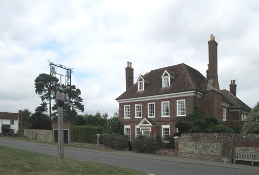
As we enter downtown Offham we are greeted by this traditional-looking house and ...
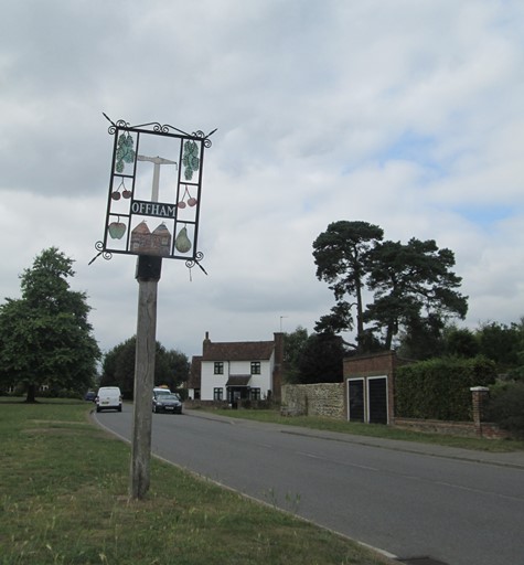
... this detailed, see-through, village sign.
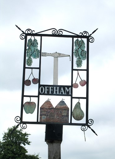
Closer inspection of the sign reveals a seemingly fruity village existence
together with - pride of place above the oast houses - a crane-like structure.
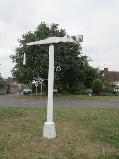
Turn around, and all is revealed.
Why, it's a real live quintain!
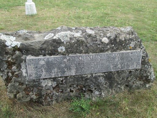
And here, chiselled in stone, is a (capital) description of a quintain and how to use it
- lest anyone should forget!
HERE STANDS AN ORIGINAL QUINTAIN A RELIC OF THE MIDDLE AGES
THE PASTIME - A ROMAN EXERCISE - WAS FOR THE YOUTH ON HORSEBACK TO RUN AT IT AS FAST AS POSSIBLE &
HIT THE BROAD PART IN HIS CAREER WITH MUCH FORCE. HE THAT BY CHANCE HIT IT NOT AT ALL WAS TREATED
WITH LOUD PEALS OF DERISION AND HE WHO DID HIT IT MADE THE BEST USE OF HIS SWIFTNESS LEAST HE
SHOULD HAVE A SOUND BLOW ON HIS NECK FROM THE BAG OF SAND WHICH INSTANTLY SWANG ROUND FROM
THE OTHER END OF THE QUINTAIN. THE GREAT DESIGN OF THIS SPORT WAS TO TRY THE AGILITY OF BOTH
HORSE & MAN & TO BREAK THE BOARD WHICH WHOEVER DID, HE WAS ACCOUNTED CHIEF OF THE DAYS SPORT.
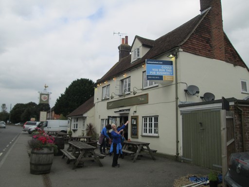
And so to the watering hole - the "Kings Arms" without the apostrophe.
"They" are looking for a new publican. Any budding publicans out there? Well now's your chance!
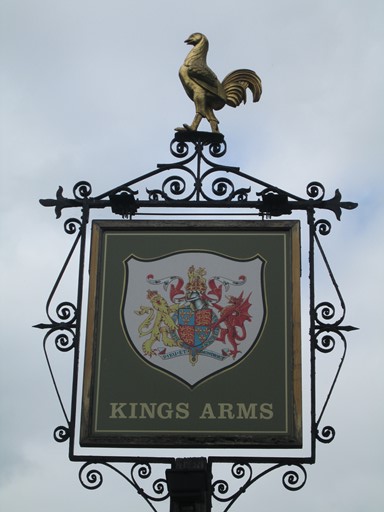
The pub sign is reminiscent of that of the pub with the same name in Shoreham (Kent). No apostrophe of course (perhaps to fox students of English), but also the English lions cavorting on the crest with those icons of things French - the fleur-de-lys.
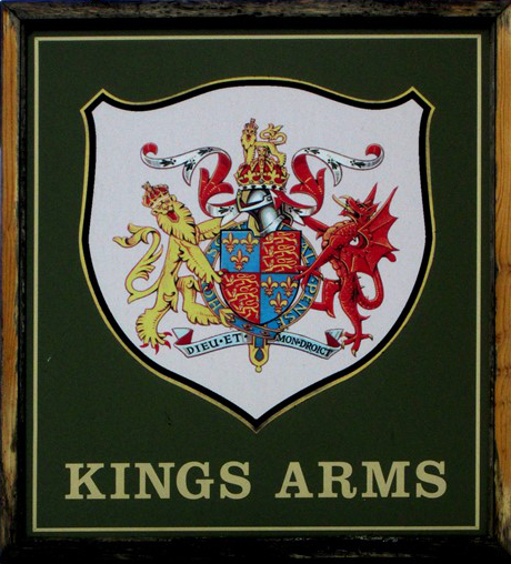
How about a closer look? Well, the crest looks nice but its origin seems to be new age and not really directly related to Royal Coats of Arms of old. Why, in Offham, the Welsh Dragon has made a getaway from the Welsh Flag and holds up the crest with the lion. Perhaps the unicorn has been devoured - single straight horn and all. However, the two French quotes remain and lend the coat of arms that official air.
Suitably refreshed, we strike roughly north east though a "lettuce farm" (or "lactucary").
Curly lettuces. Green lettuces. Purple lettuces.
All seemingly catering for the healthy eater.
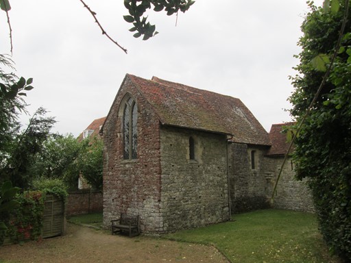
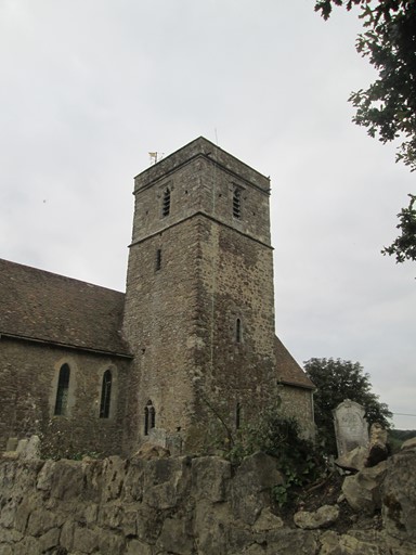
After the lettuces, it's Offham Church.
Now Offham Church really is a visit for anyone who appreciates English history - no, not history as "she" is taught, but history as "she" is revealed "in bricks and mortar". It's almost as if the historical events were coming into our own world.
So, dear reader, come into the church by clicking on the picture, and have a look round.
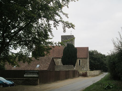
As we head for East Malling we have this last view of Saint Michael's Church
across myriad rows of lettuces: green, purple, frizzy and not so frizzy.
Our world seems to be full of lettuces: green, purple, frizzy and not so frizzy.
East Malling marks the End of Our Fine Sunday Walk
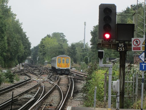
The final part of our walk took in Saint Leonard's Tower and the "Manor Park Country Park". Some apple orchards later and we arrived at the picturesque village of East Malling. It was here that the traditional "King & Queen" watering hole cast its spell over those in our group who are devotees of the product of the hop. A pint or two to round off the day in quaffing style. After this we made a reasonably quick getaway on a Southern train, today not strike-bound. The somewhat minimalist and ultra-functional station - East Malling's very own - awaited us just around the corner.
It was on this final "leg" of our walk from Offham to East Malling that Nick educated us in linguistic matters Kentish. I mean, we all knew how to pronounce "Wrotham" and "Igtham" without giving away that we were actually from across the county border. But "East Malling"? Think of a wild animal mauling its unfortunate prey. Then you'd be there - pronunciation-wise. Now "Trottiscliffe", well that's a collector's item. The nearby Country Park just south of Vigo Village wasn't spelled "Trosley Country Park" for nothing. The local pronunciation of "Trottiscliffe" was even too much for those in the naming department of the Kent County Council Offices; they took mercy on the prospective visitors to the said Country Park.
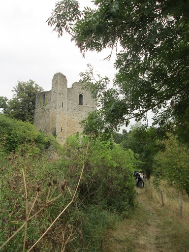
Saint Leonard's Tower is a sort of southern gateway to West Malling.
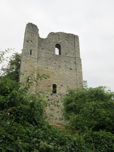
It is a small free-standing Norman tower keep.
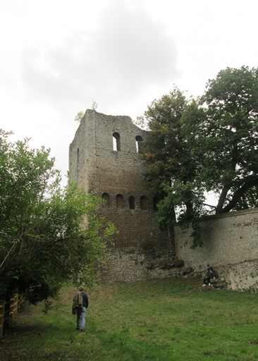
It was built between 1077 and 1108 by Gundulf, Bishop of Rochester.
Apart from this, the plot thickens.
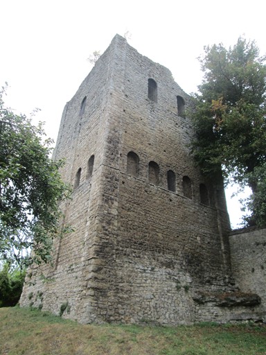
Was it part of a larger castle? Was it the tower of a quondam church dedicated to Saint Leonard?
Was it an administrative centre for the estates (worldly) of the local bishopric (religious)?
The muddied waters of history ebb and flow over the debates of the learned historians.
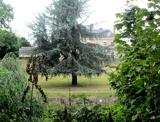
Instead of making a short cut through the "Manor Park Country Park" we had the chance to make a detour and take in a number of additional aspects. The house on the lake was the original "raison d'être" for the park. The house was built about 1738, the Manor Park being its associated 18th Century estate. The house had a chequered history, being used in WWII as an RAF Officers' Mess for the nearby aerodrome. Now the house has succumbed to the seemingly inevitable, having been converted to apartments (definitely not flats!)
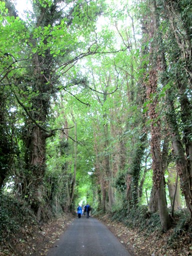
Another advantage of making a detour through the Manor Park Country Park was that we had the opportunity, on leaving the Park, to walk this magnificent "tree arch" avenue - its magnificence accentuated by the verdancy of late summer.
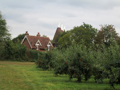
Some more apple orchards and oast houses later, and we reach East Malling.
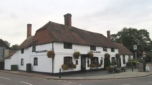
Now we come to East Malling's "King & Queen" in all its glorious traditional centuries-old sprawl. How many devotees of the hop
have savoured the amber liquid in ages past in this very establishment?
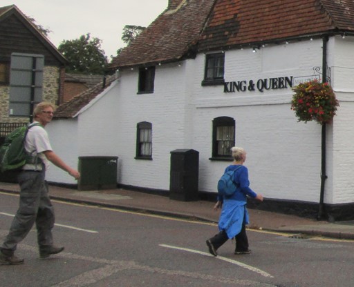
These are not the King and Queen, but CLOGgie stalwarts. They are some of the devotees of our group to products of the hop and they are boldly going to where many have gone before. In this case, they will be enjoying the final pint(s) of the day before our respective homeward journeys beckon.
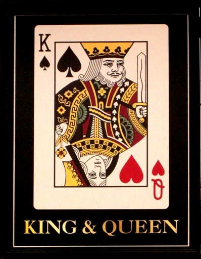
The over-indulgent, on leaving the said watering hole,
might possibly think they have seen a new kind of playing card.
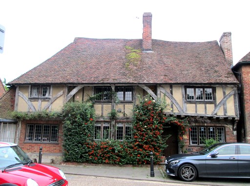
Nearby, this timber-framed house cannot escape the 4-wheel manifestations of present day existence - manifestations assembled as if to protect the said building.
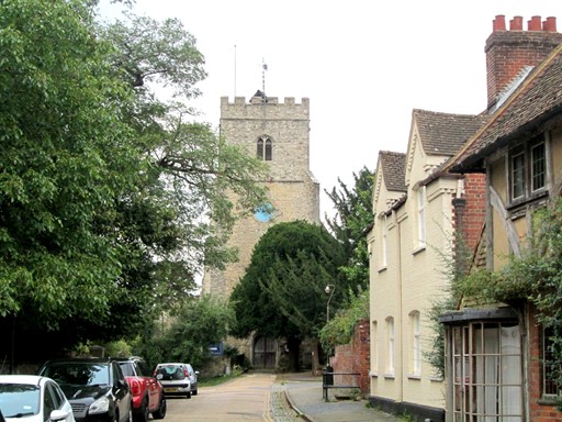
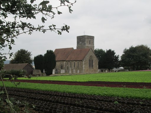
And here, we end with a picture of East Malling's historical and picturesque village centre, flanked by traditional houses including the one in the previous picture, but dominated by the church of Saint James. This church is a Grade 1 listed ragstone church with Norman, Mediaeval and some Victorian credentials. The six bells (the first five hung in 1695) make sure that parishioners do not miss important ecclesiastical events.
Thank You All for a Nice CLOG Day Out!
And now time moves on for us, as we contemplate our respective homeward journeys. It's time to say: "Thank you Nick for suggesting and leading this walk. Thank you everyone for your company. Thank you to the weather gods for bringing good walking weather." Indeed, we should reiterate that CLOG, to its great credit, has the flexibility which allows us to plan walks at short notice of just a few days in response to positive weather forecasts. So, another successful CLOG day out!
Eric Scharf
Original: 2016-09-30 @12:07
SAGAX REX HANC RETIS ORBIS PAGINAM PINXIT ANNO MMXVI.
© Eric Scharf