 |
Epping to Harwich ESSEX WAY An 81 mile Institution |
|
| Epping-Ongar Peppers Gr Gt Leighs Coggeshall W Bergholt Lawford Harwich Read Me |
The Essex Way and I
T he Essex Way has become an institution since its conception in 1972. It takes in 81 miles of varied Essex landscape, with its gentle ups and downs, seascapes, and a leafy green countryside simply oozing English history at almost every step. End points are Epping Station (Central Line) and Harwich High Lighthouse near Harwich Station (Network Rail).
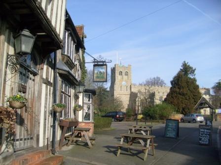
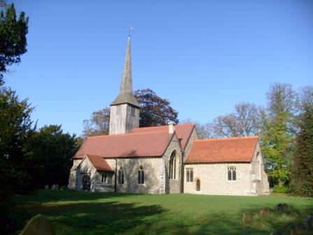
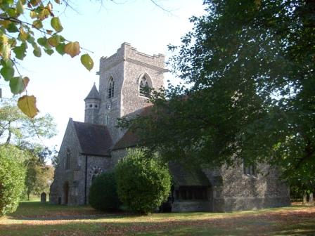
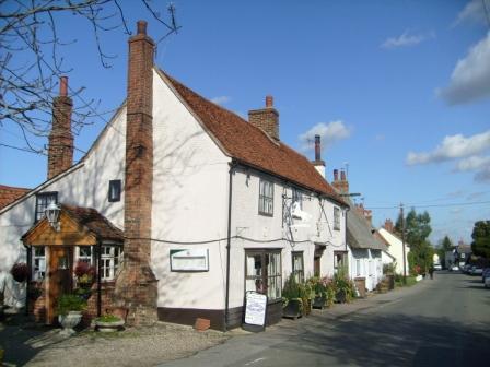
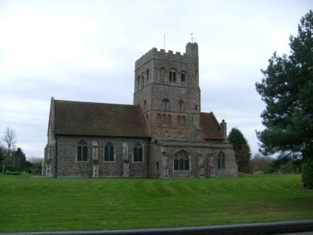
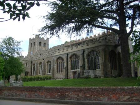
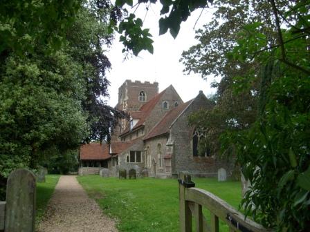
The Essex Way comes through historic Coggeshall, in whose centre stand the two institutions spiritual: the "Woolpack" and the main church - Saint Peter ad Vincula (St Peter in Chains). The "Woolpack" indicates that Coggeshall was an important mediaeval business centre, the business being wool. The church is one of the largest in Essex - it could have been a cathedral, but Chelmsford won the day.
Celebration. I have just completed the last (15 mile) section from Harwich to Manningtree (Tuesday, June 23, 2009), and thought that a small celebration in the form of this web page might be in order. I hope that you like the pictures (for what they are worth!), and that what you see will encourage you to get your boots on, pack your camera, and start walking the Essex Way!!
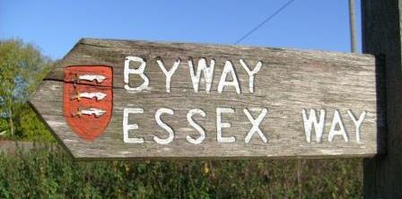
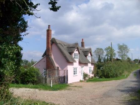
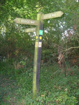
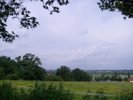
The Essex Way is reasonably well sign-posted and maintained, although an OS Map is always a useful companion, if only to show points of interest in the wider vicinity. This Essex Way sign is between Pepper's Green and Good Easter.
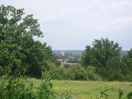
The pictures you will see are a selection of ones I have taken at at different times and seasons in 2008 and 2009. The pictures provide a small preview of what you will see and experience on the different stages of the Essex Way. After each stage you can come back to them to see how many of the scenes you recognise as ones you have enjoyed - albeit perhaps at a time of year different from that in which I originally took the pictures.
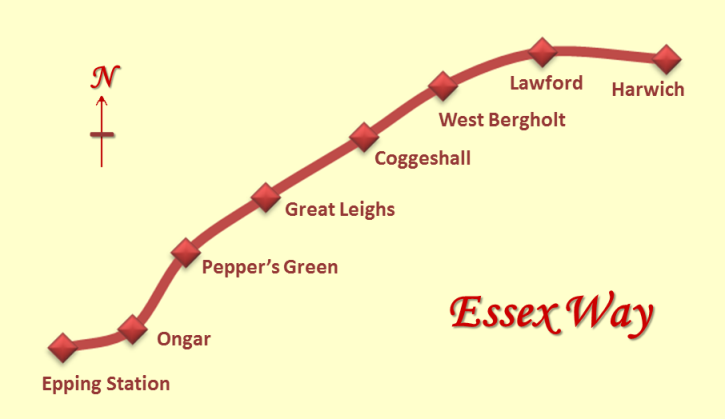
The stages. I partitioned the walk into seven stages on the basis of public transport to the start and end points. The stages are shown in the above overview map and just below. Each stage had an average length just under 12 miles, with the Epping to Ongar stage being the shortest at about 8 miles, and the Lawford (near Manningtree) to Harwich stage being the longest at about 16 miles. Inevitably, some stages are only accessible by public transport on days other than Sundays and public holidays.
- Epping to Ongar
- Ongar to Pepper's Green
- Pepper's Green to Great Leighs
- Great Leighs to Coggeshall
- Coggeshall to West Bergholt
- West Bergholt to Lawford (near Manningtree)
- Lawford (near Manningtree) to Harwich
1. Epping to Ongar
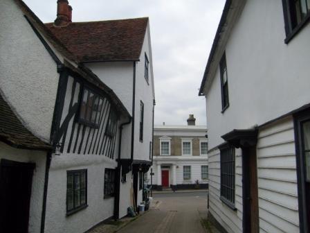
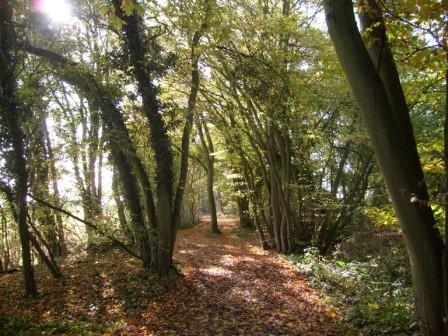
E pping Station, the end the Central Line, marks the start of the 81 mile long Essex Way. This first stretch, to Ongar, is characterised by ancient woodland, with connections back to Anglo-Saxon times: Gernon Bushes contain pollarded Hornbeams, and Ongar Great Park is the oldest recorded deer park. Another - and famous - Saxon connection on this walk, is Greensted Church, dating back to 645 AD. Ongar, with its castle remains, its old church and half timbered buildings nodding to each other, evokes yet more history. Toothill, which used to be a lookout for highwaymen such as Dick Turpin (hence the "toot"), brings us closer to modern times. Highwaymen disappeared with the coming of the railways, and on this section of the walk, we are never far from the Epping-Ongar Railway, which is being restored by enthusiastic volunteers and is now partially open to the public.
When I did the walk, the weather was typical for the end of March with cloudy winter still hanging on, but I managed to get some pictures. The date was Tuesday, March 31, 2009. The walk was short, so being keen to make up for this, I then walked from Ongar to Blackmore (the first part of St Peter's Way).
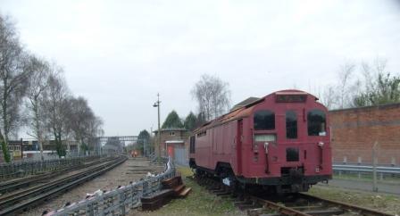
Epping is the end of the Central Line and here is a bit of Underground history in the shape of this electric locomotive built by London Transport in a "do-it-yourself" fashion.
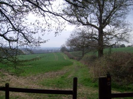
On leaving Epping, gently rolling countryside ...
... greets us as we approach Gernon Bushes
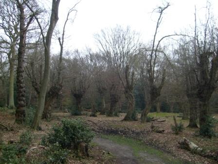
In Gernon Bushes, pollarding goes back over a thousand years, to Anglo-Saxon times.
The pollarded trees are mainly hornbeams.
The Epping Ongar Line lives on
Greensted Church: reputedly the oldest wooden church in the world
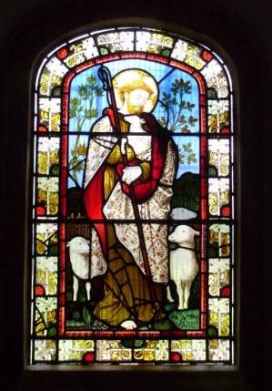
Greensted Church: a more modern - Victorian - stained glass window
Greensted Church: porch with the grave of the Unknown Crusader
Greensted Church: the north side
Ongar: houses near the high street nod to each other ...
... as the venerable church of Saint Martin looks on
2. Ongar to Pepper's Green
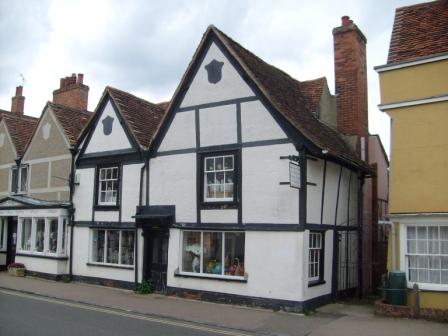
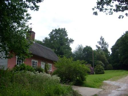
Village churches tend to say a lot about the history of the communities they serve. The two churches at Willingale share the same churchyard but actually belonged to bordering parishes, Willingdale Spain and Willingdale Doe. The church at Fyfield has an unusual spire, and the church at High Ongar was "got at" by over-zealous Victorians. At Cannon's, Green, there is something of a rarity in the shape of what might be the only thatched caravan in the world.
My walk was on a lovely sunny autumn day, fresh and a bit icy, but ideal for walking and taking pictures. The date was Wednesday, October 29, 2008. Because of travel considerations, I did the walk in the London direction. The start, at Pepper's Green, appears to be "in the middle of nowhere", and evokes surprise from bus-driver and passengers alike, when I ask to alight here.
On the way from Pepper's Green to Willingale:
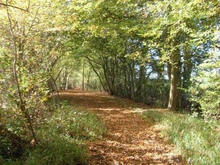
sun and shade pattern the already leaf-strewn bridle way
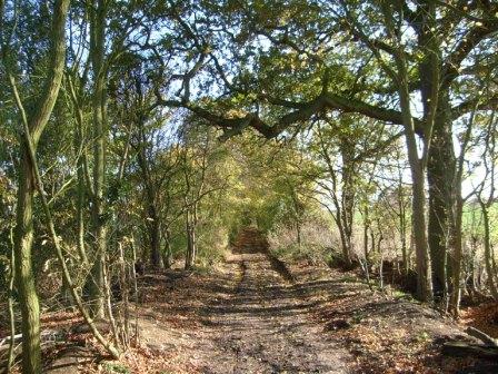
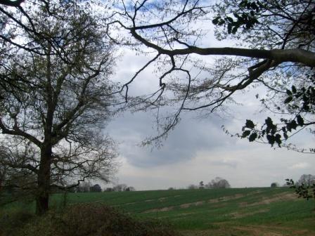
Summer lingers on ...
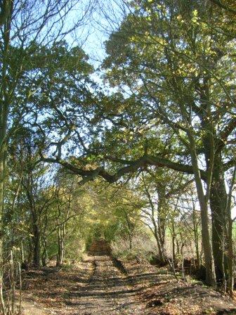
... to give an early autumn feast of light and shade, greens and browns
Willingale: an Essex oddity - one churchyard, two churches
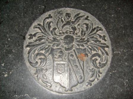
Willingale: embedded in the floor of the smaller church are the arms of a long forgotten person of distinction - sic transit gloria mundi.
Fyfield Church ... within
... and without, but with a strange spire ...
... and stranger still, a thatched caravan lurks not far away at Canon's Green.
The evening makes a nice silhouette of High Ongar Church ...
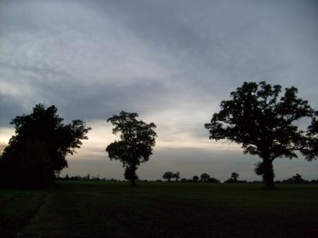
... and of the trees between Ongar and Greensted Church. If this looks out of sequence, don't forget that I did the walk from Pepper's Green TO Ongar.
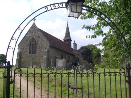
3. Pepper's Green to Great Leighs
The churches at Good Easter, High Easter, Great Waltham and Little Leighs are certainly all worth visiting. However, on this part of the walk, the historical mix is made even more interesting by the village of Pleshey of Shakespearian fame and by Langleys, the imposing Queen Anne residence of the Tufnell family.
What a fine and fresh autumn day. The date was Wednesday, October 22, 2008. Once again, I surprised the bus driver and his human charges by requesting to alight "in the middle of nowhere". This time I am walking towards the East, in fact to Great Leighs, home of the short-lived race course, which might be reopened some day.
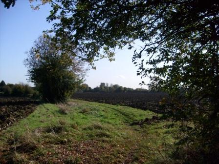
On the Essex Way between Pepper's Green and Good Easter.
Good Easter Church
Leafy bridle Way between Good Easter and Pleshey.
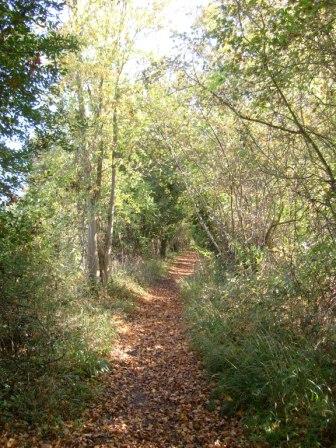
More leafy encounters between between Good Easter and Pleshey.
Near Pleshey of Shakespeare Fame.
Pleshey Church - looks a bit Victorian.
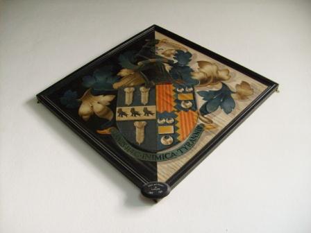
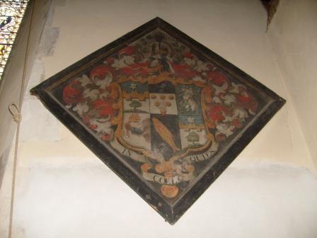
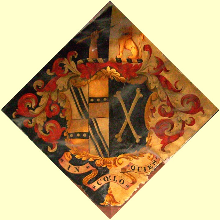
Latter-day hatchment in Pleshey Church.
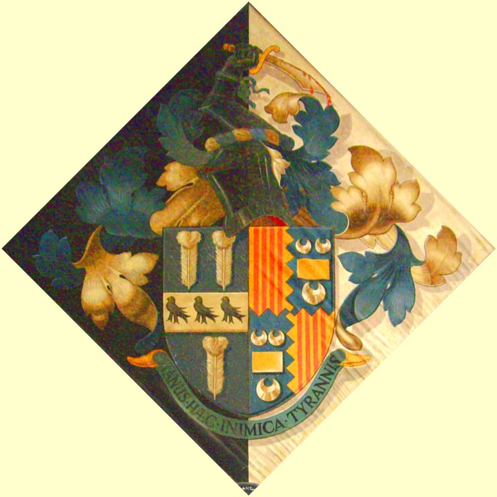
The same hatchment given the "GIMP" treatment.
The inscription reads:
MANUS HAEC INIMICA TYRANNIS
"This hand is hostile to tyrants."
The quotation has links to Algernon_Sidney and to the early years of the USA.
Down-town Pleshey - the famous castle with Shakespearian connections is permanently in hiding.
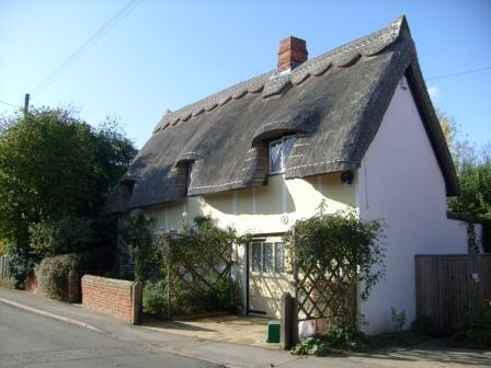
Pleshey - thatched house.
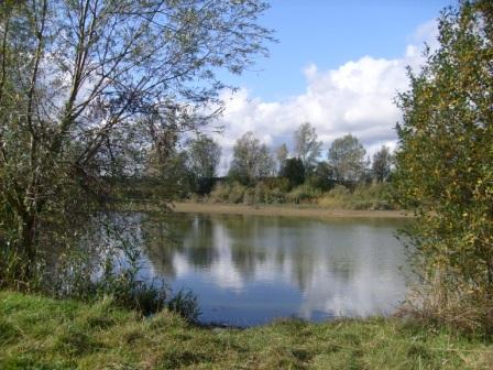
Here is a tranquil pond hiding in the fields between Pleshey and Great Waltham. This pond is probably used as a water supply for agricultural purposes. Such water "reservoirs" are quite common in Essex.
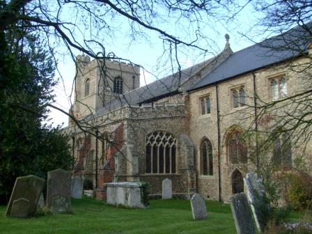
Great Waltham Church
This half-timbered house nestles comfortably on one side of the church grounds - as it has done for centuries.
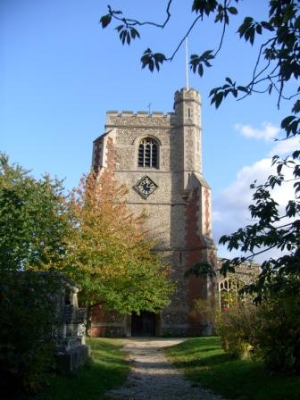
Great Waltham Church
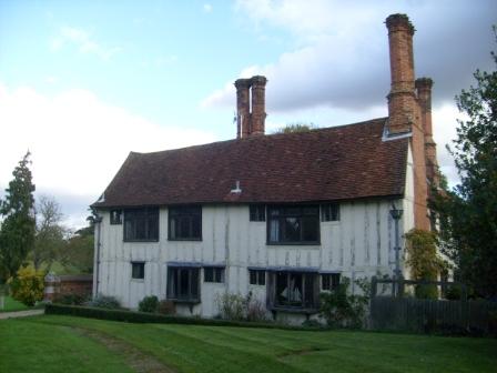
In 1710, Langleys Estate was acquired by the Tufnell family who built this Queen Anne style residence. The name is also connected with Tufnell Park in North London.
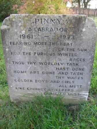
Grave of a beloved Labrador who lived for 12 human years, or 84 years in dog years.
Little Leighs Church: interior.
A nicely painted hatchment in Little Leighs Church refers to resting in heaven - presumably for members of the distiguished family represented by this hatchment.
Another hatchment which has been given the "GIMP" treatment.
Is that a Talbot top right?
Little Leighs Church: porch.
Little Leighs Church: south aspect.
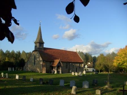
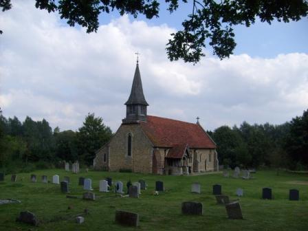
4. Great Leighs to Coggeshall
The distinctive round tower of Great Leighs Church, the early mediaeval wall paintings of Fairstead Church, the village of Terling, the Queen Anne residence of Langleys and the Great Barn at Coggeshall were some of the notable features of this part of the Essex Way.
This walk was done on two different days, and the walks on both days were blessed with good walking weather.
Little Leighs to Terling - September 18, 2008
Walking into Little Leighs from the East.
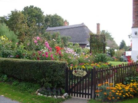
Before reaching Little Leighs Church there is "Rose Cottage" - a name very widely used in Essex!
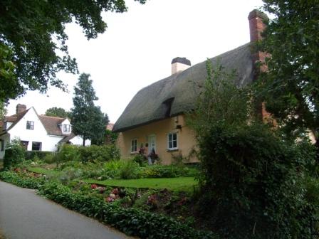
A thatched house on the way to Little Leighs Church.
Approaching Little Leighs Church through the memorial gate.
Little Leighs Church: south west aspect.
Opposite Little Leighs Church.
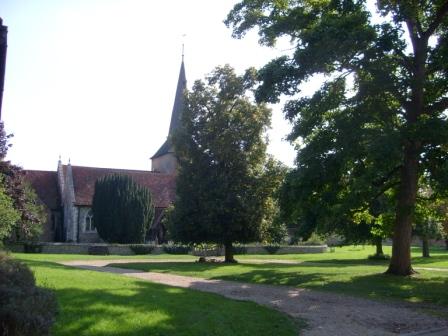
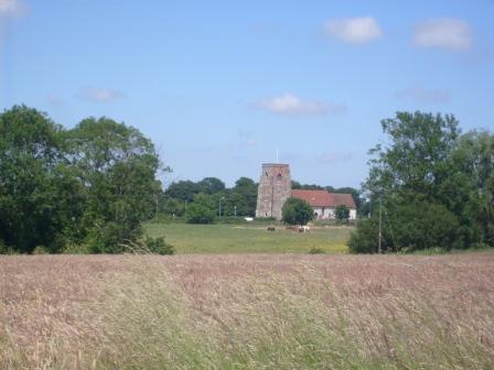
This is the round tower of the Norman Great Leighs Church. The church is more than mile outside Great Leighs, the community it was built to serve. Perhaps the idea was to put the religious fervour of the parishoners to the test!
A nice thatched cottage greets the walkers as they come into Terling.
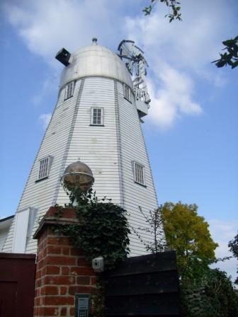
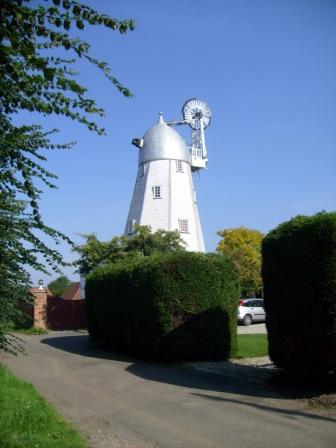
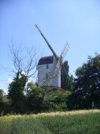
The smock mill in Terling is now minus its sails and has been made an interesting private residence. With sails, it was one of the stars of Will Hay's "Oh, Mr Porter".

This is the village green in Terling - nice but only two return buses a week!
The gatehouse (seen from the churchyard) to Terling Place, home of the Rayleigh family of physics and dairy fame.
Another view of Terling's village green.
Terling Church, quite old, but converted in the 1700s for the benefit of the Rayleigh family.
Another view of the gatehouse.
Great Leighs to Coggeshall - September 20, 2008
On the Essex Way between Great Leighs and its church.
Great Leighs Church seen from its churchyard.
A close-up of the round tower ...
... and the Norman archway at its base.
Terling windmill again.
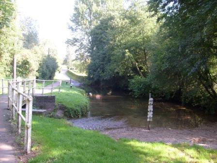
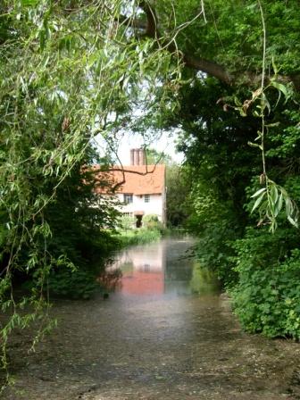
Coming into Terling, the walker is greeted by a ford, but luckily there is footbridge as well, to avoid wet feet - the water can reach several feet of depth when the stream is in full spate.
On the other side of Terling one comes to Fairstead, whose church has some interesting mediaeval paintings.
Fairstead Church from the outside. Tranquility rules OK.
On the way to Bradwell - not the one with the power station!
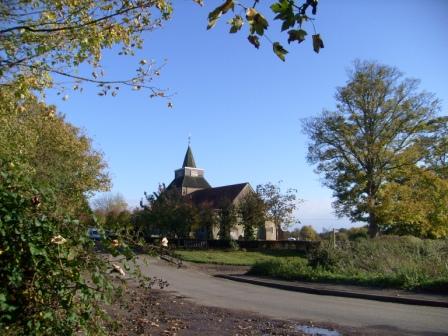
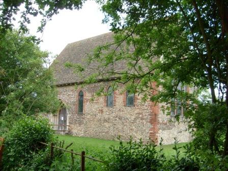
Bradwell Church seen from its churchyard.
Another view of Bradwell Church.
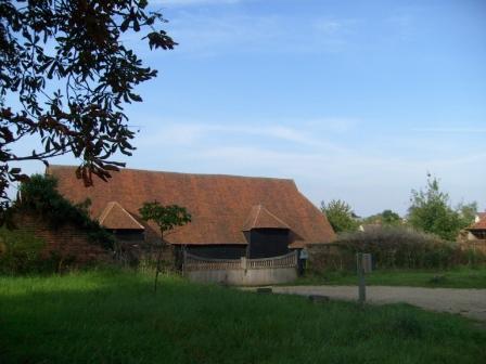
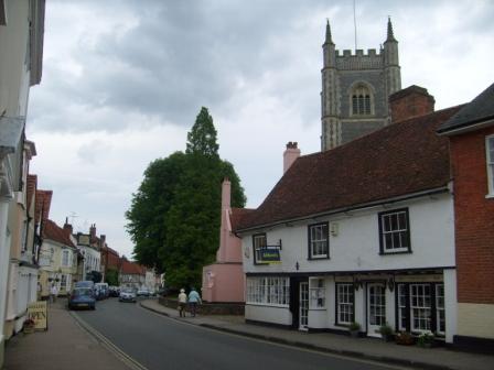
And so to Coggeshall with its Great Barn - apparently the largest in England and originally used by the old priory nearby. The priory is long gone - Henry VIII saw to that.
5. Coggeshall to West Bergholt
C oggeshall was a prosperous mediaeval business centre, with - guess what - wool as the staple trade. Old buildings such as Paycocke's house, bear withness to this age of prosperity. The Chappel railway viaduct bears witness, in its turn, to the Victorian age of prosperity, when railways spread their tentacles to almost every corner of the land. West (not East!) Berholt, at the other end of the walk, is also certainly not without historical interest.
The main part of this section of the Essex Way was "walked" on two different days. The first time (2008 November 21) was from West Bergholt almost to the outskirts of Coggeshall. The second time (2009 January 30) was from Coggeshall to West Bergholt. These were winter walks, but again, both walks were blessed with good weather. The days are presented here in reverse order.
The third and fourth set of pictures are from targetted visits to Chappel and Wakes Colne (2008 May 14) and to Coggeshall (2008 May 20) respectively. Despite the targetted nature of these two visits, it was felt that the pictures taken on these occasions would provide a fitting addition to this web-based presentation.
- West Bergholt to Coggeshall - 2008 November 21
- Coggeshall to West Bergholt - 2009 January 30
- Chappel and Wakes Colne - 2008 May 14
- Coggeshall 2008 May 20
Coggeshall to West Bergholt - January 30, 2009
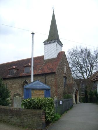
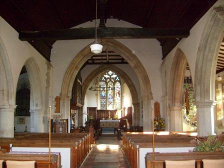
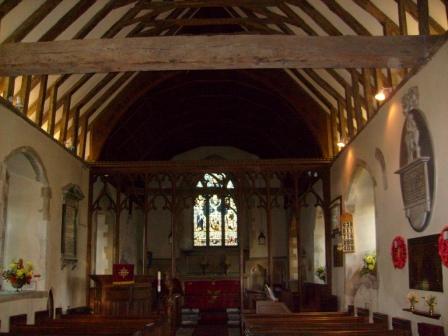
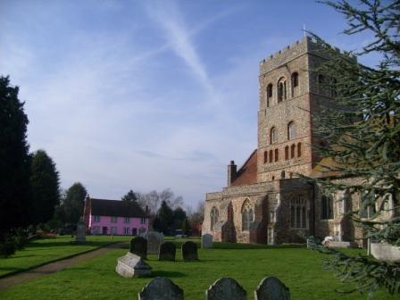
Two institutions spiritual in the centre of Coggeshall: the "Woolpack" and the main church - Saint Peter ad Vincula (St Peter in Chains). The "Woolpack" indicates that Coggeshall was an important mediaeval business centre, the business being wool. The church is one of the largest in Essex - it could have been a cathedral, but Chelmsford won the day.
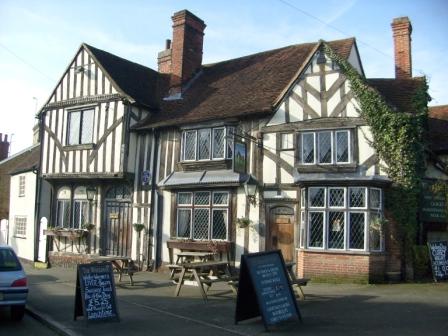
The "Woolpack" is a nice timbered building.
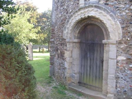
The church can be approached from the south west through a well kept churchyard.
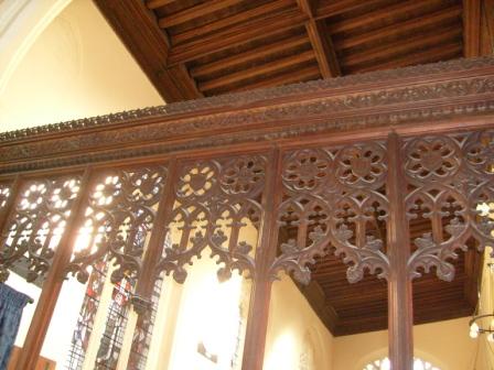
The church has an ornately carved "Rood" screen ...
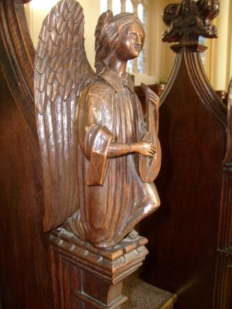
... and an angel plays suitably angelic music in the choir stalls.
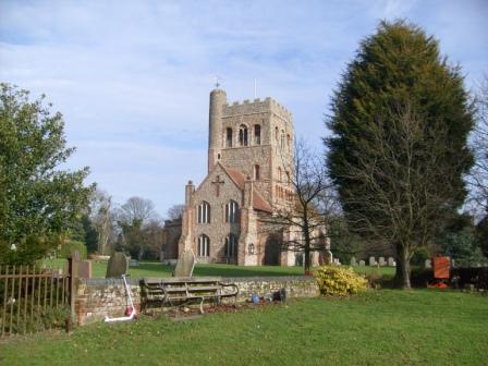
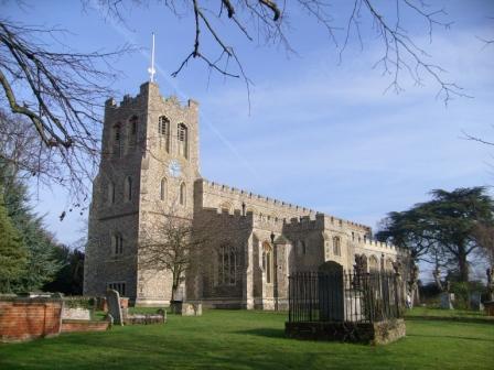
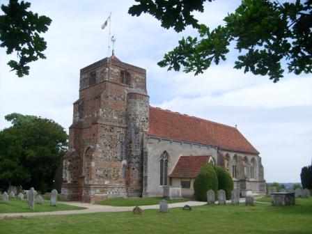
Great Tey Church. In the Victorian times the local parish almost went bankrupt "restoring" this church. Had they not done so, we would have a lovely Norman church today!!
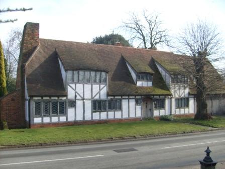
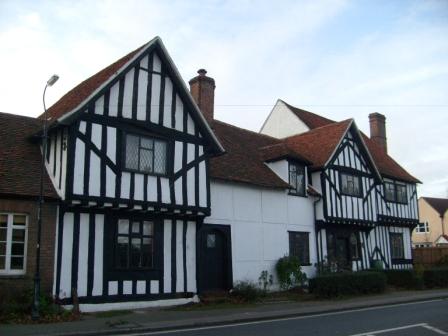
Oppopsite the church is a nice half-timered house - mediaeval or tudor.
Great Tey Church again. The Victorians did not destroy quite everything because the Norman tower still remains!
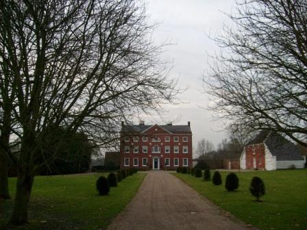
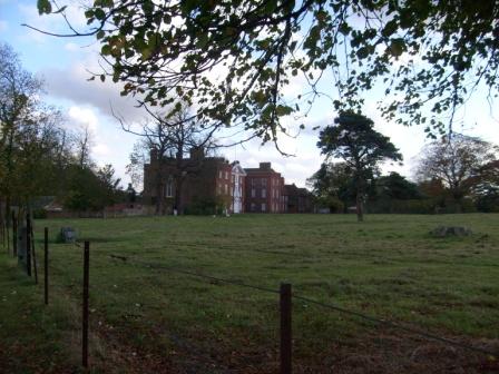
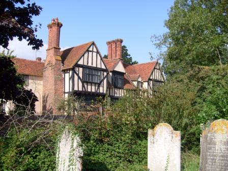
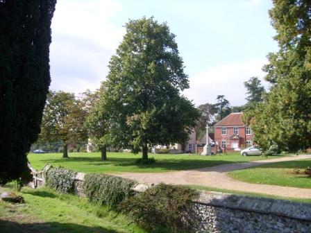
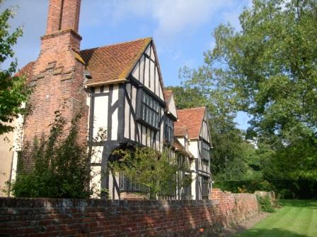
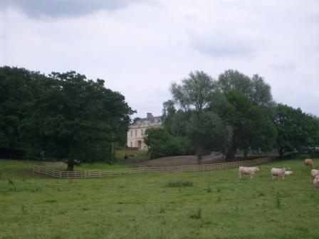
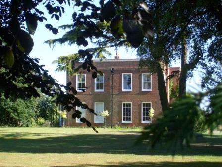
West (not East!) Bergholt Hall.
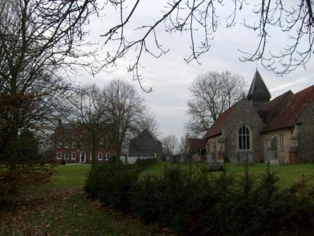
West Bergholt Hall and Church in a typical juxtaposition - the mediaeval axis of power. The squire and the man of the cloth - temporal and spiritual - between them ensured that the local village residents were kept in their stations.
West Bergholt to the outskirts of Coggeshall - November 21, 2008
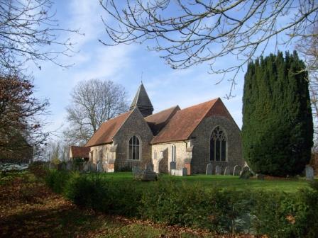
West Bergholt Church again - now saved from disintegration by the "Friends of Friendless Churches".
West Bergholt Hall
On the way to Ford Street.
Coming into Ford Street from the East.
Ford Street.
Great Tey Church.
The sun sets near Marks Tey.
Chappel and Wakes Colne - May 14, 2008
A distant view of Chappell viaduct as seen from the Essex Way. There is supposed to be a bull somewhere in this field!
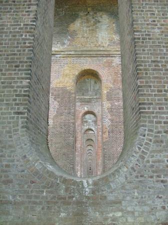
Chappell Viaduct - Underneath the Arches.
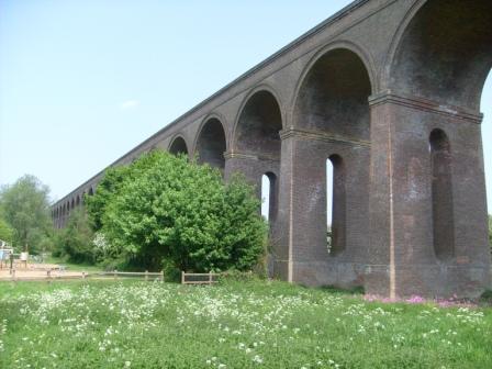
The majestic expanse of Chappell Viaduct.
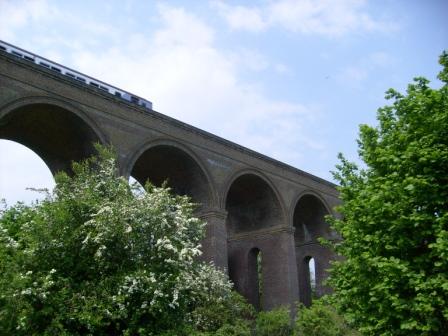
The viaduct still carries the Gainsborough line high above the Colne Valley. Beeching tried to close this busy line to Sudbury - but luckily the wishes of distant bureaucrats were nicely squashed.
Coggeshall - May 20, 2008
Although Henry VIII destroyed a lot of the Cistercian abbey to the south of Cogeshall, this gate-chapel still survives and serves today as a wedding chapel.
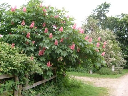
In late spring, the grounds of the former abbey are graced by a colourful display of horse-chestnut trees in full blossom. Definitely not to be missed!
This is probably Paycock's second (family) house, standing within the grounds of the former abbey.
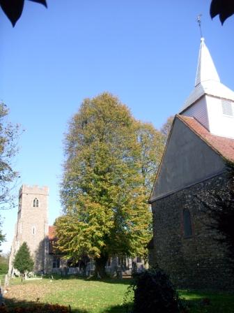
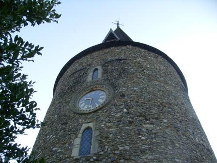
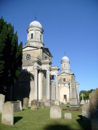
Coggeshall church was once considered as the Cathedral for Essex, but Chelmsford won the day.
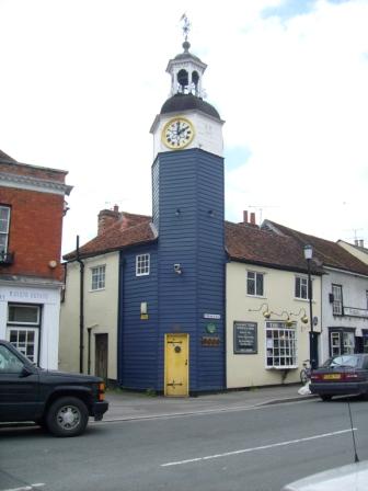
The Victorian clock tower is a Coggeshall landmark. Luckily, the Victorians did not vent more of their restoration zeal on Coggeshall!
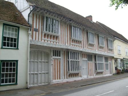
Paycocke was a wealthy cloth merchant, and his splendid 16th century house in Coggeshall has survived long enough to be taken under the aegis of the National Trust.
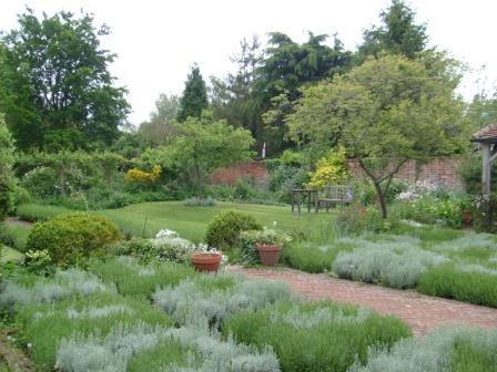
The garden at the back of the house is presumably a recreation of the original 16th century garden, as Paycocke himself would have seen and enjoyed it.
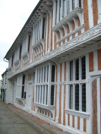
Here is the front of Paycock's again. You can see the carvings which exuded wealth and status.
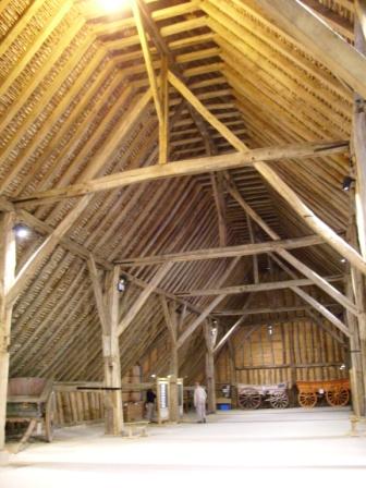
The nearby 13th century Grange Barn, one of the largest of its kind in Essex, probably belonged to the Cistercian abbey.
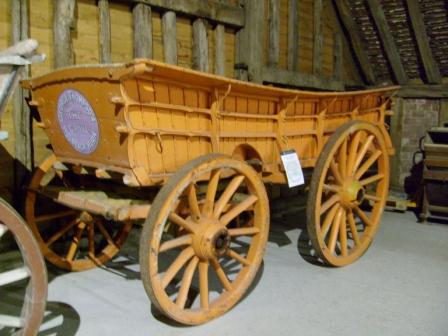
Inside the barn there are a number of ye olde agricultural vehicles, including this haywain or hay wagon.
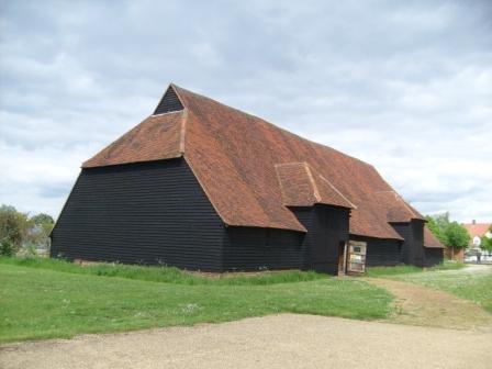
Here is the barn from the outside. It is also owned by the National Trust.
The mill closeby was probably also connected with the abbey. With all this wealth, no wonder Henry VIII was keen to avail himself of the assets of the abbey.
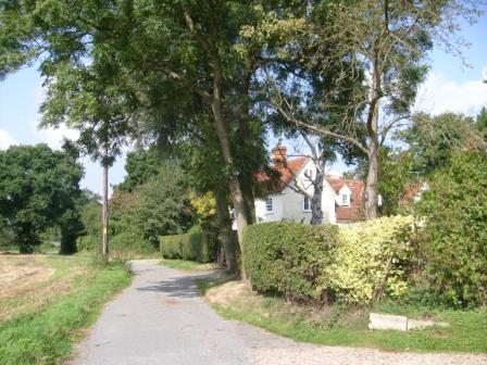
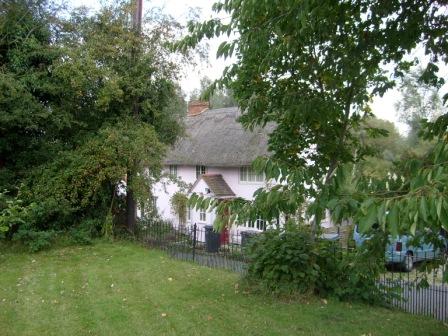
6. West Bergholt to Lawford (near Manningtree)
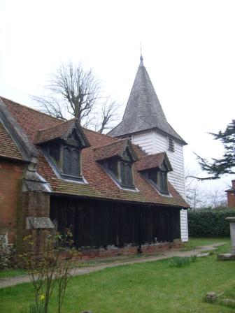
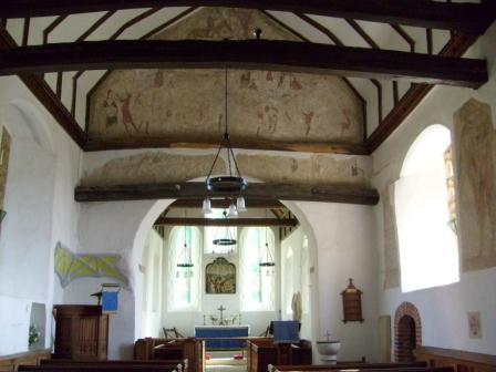
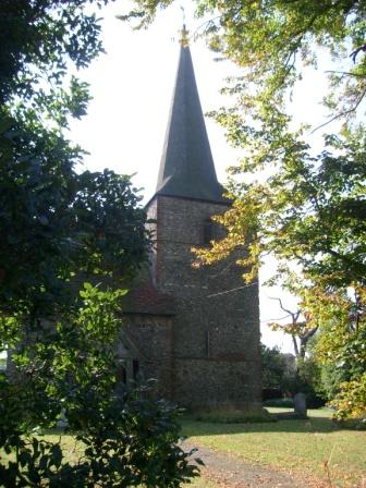
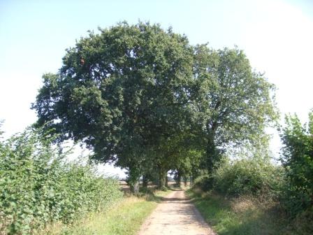
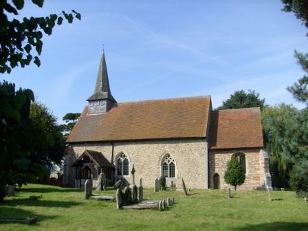
This part of the Essex Way is in fact the southern part of the well known circular Constable Country walk. After West Bergholt, a vineyard complete with wine tasting gave this walk added zest. We then pass Lawford Hall and visit Lawford church with its "Dumb Animals Petition" and other items of interest. Then we enter Constable Country and head for Dedham, with its traditional buildings, including Shermans, where the ancestor of General Sherman (of USA tank fame) once lived. As can be expected, the time-honoured Dedham church is steeped in history. Just across the rtoad from the church, the Duke of Wellington pub (which does a good cider), used to be the local Wool Exchange, for Dedham, like Coggeshall, grew prosperous when the mediaeval wool trade was in its heyday. Lawford church, just south of Maningtree Station, also has an interesting history to tell; Cromwell did not like the 14th Century stone renditions of locals merry making, but luckily some of this art has survived his destructive influence for us to marvel at.My walk was on Wednesday June 17, 2009. The weather was good for walking - not too hot and a mixture of sunshine and cloud. For logistical reasons, I did the walk in the reverse direction (towards London).
Lawford Church
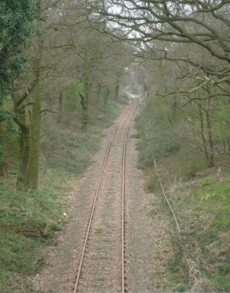
A wooded part of the Essex Way before it crosses - at track level - the main Liverpool Street to Norwich line.
A view over Dedham Vale ...
... here with Dedham Church, as Constable might have seen it - for it was a subject of one of his paintings.
Guarding the way to Deedham is the mock-Tudor des-res, complete with summer flowers.
Down-down Dedham is full of traditional houses, ...
... presided over by its time-honoured church which featured in Constable's Dedham Vale painting.
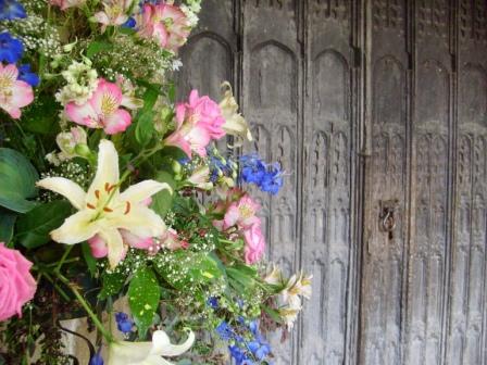
The transient and the permanent: freshly cut flowers adorn the age old main door to Dedham's church.
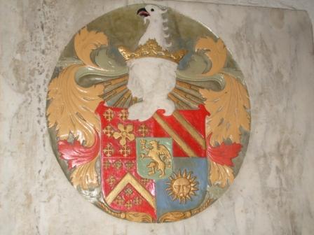
This colourful stone nmonument, embedded in the floor of Langham church, commemorates a local dignitary from ages past. But who?

This "dumb animals' petition" harks back to the time when the steep hill nearby was part of the main road to the Eastern Counties (before the A12) and witnessed many injustices exacted by cart drivers on their horses.
Lawford Hall nestles peacefully in the peaceful landscape.
A thatched cottage nestles peacefully in the landscape near Rivers Hall.
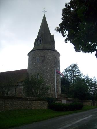
Boxted Church is on the way to the vineyard and to Great Horkesley.
7. Lawford (near Manningtree) to Harwich
M anningtree is the railway junction, where the line to the once famous seaport of Harwich diverges from the main line to Ipswich, Norwich and the furthest reaches of the Eastern Counties. The nearby Mistley towers are the remnants of Robert Adams's 18th Century church. Malty aromas from the nearby English Diastatic Malt Extract Company often provided added spice to the scene. Then comes Bradwell, followed by Wrabness with its nature reserve and the church with its free-standing bell cage, reminiscent of East Bergholt. The Suffolk coast line stretches along the other side of the Orwell Esturary, all the way to Harwich. We then come to Ramsey, with its post-mill. Up and out of the dip in which Ramsey village lies, we eventually come to the wide sweep of Dovercourt Bay, with its light houses. And so to Harwich with two more light houses, interesting old buildings, the Electric Palace, and views of Felixstowe Docks on the Suffolk side. The High Lighthouse in Harwich, close to the railway station, marks the end - or beginning - of the Essex Way - all 82 miles of it.Tuesday June 23, 2009
The weather was rather hot with a clear blue sky - only a few wisps of cloud. I downed almost a litre of water on the way. (For logistical reasons, I did the walk in the reverse direction - towards London).
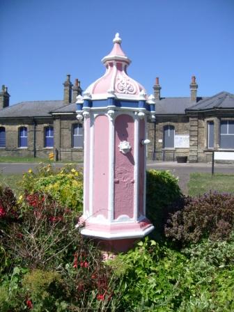
This erstwhile drinking fountain stands guard outside Harwich Station.
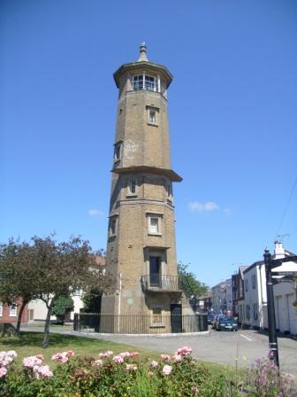
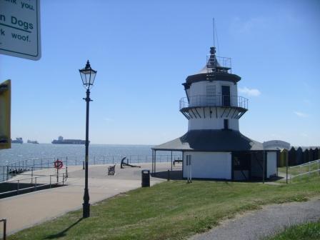
Near Harwich Station stands the High Lighthouse, the official start (or end) of the Essex Way.
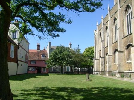
A corner of old Harwich by the church.
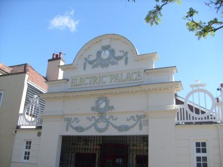
Harwich boasts Britain's oldest cinema, which dates from Edwardian times and is still in use.
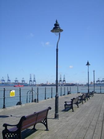
Part of Harwich's water front, with Felixstowe docks on the Suffolk side of the Orwell.
Another glimpse of old Harwich.
The Low Lighthouse hosts a radio museum.
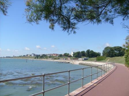
The wide sweep of Dovercourt Bay.
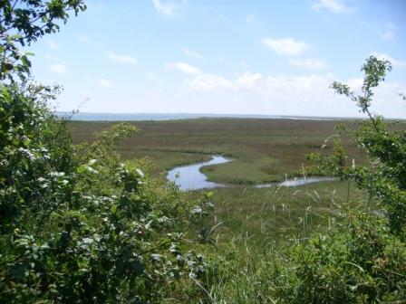
Wrabness Salt Marshes.
Looking back, there is a further view of the salt marshes, ...
... whilst walking in the opposite direction, Ramsey church hoves into one's sights.
Here is Ramsey post mill, now a private residence.
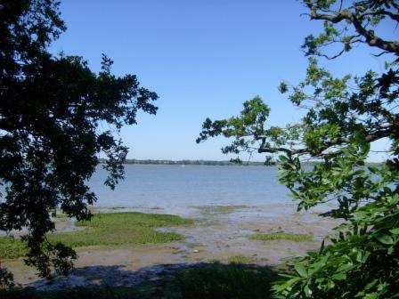
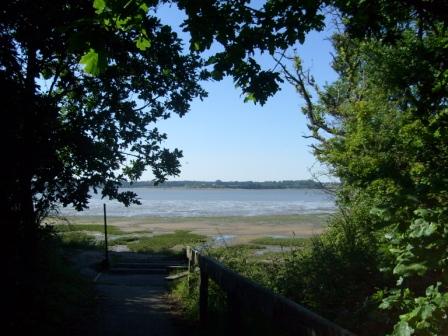
We are now at the water's edge of the Orwell Esturary, at Copperas Bay in fact. Suffolk lies on the opposite shore.
Here is another view at Copperas Bay. Copperas, also known as bisulphide of iron, was dredged from the mud here, and used for making inks, dies and sulphuric acid.
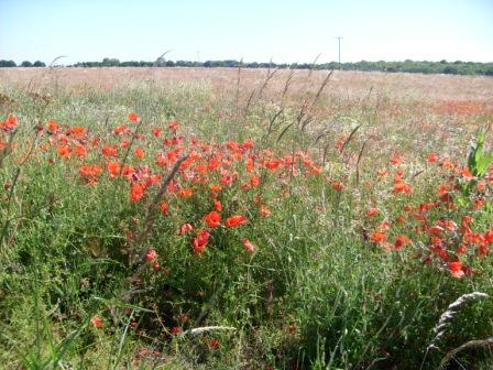
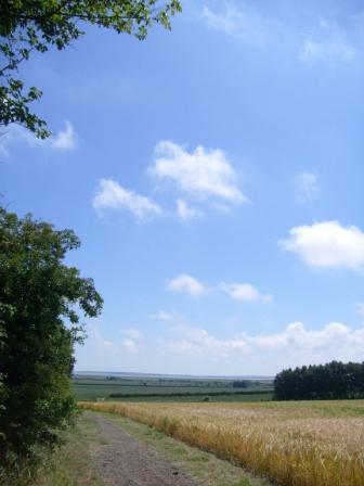
Opposite Wrabness Church is a field of wheat, edged by the flower of Essex - the poppy.
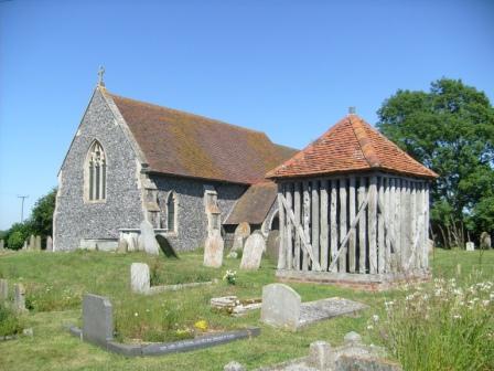
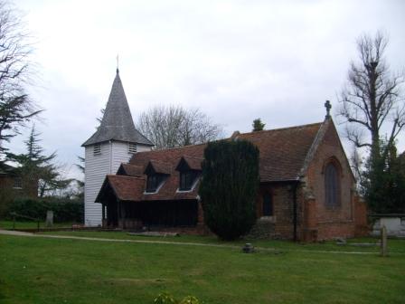
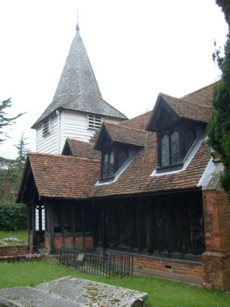
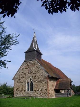
Wrabness church has a separate, free-standing, wooden bell-cage, reminiscent of East Bergholt Church.
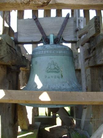
One of the bells was cast at Whitechapel bell foundry.
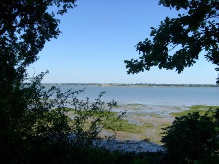
The Orwell and Suffolk again, seen this time from Jacques Bay.
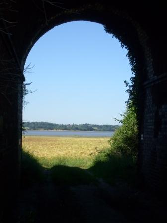
It's under the railway line to Bradfield, but looking back to the Orwell and Suffolk.
This could be Bradfield Place.
These are definitely the Mistley Towers.
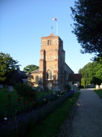
Here is Lawford Church in the evening sun.
Postscript
The Essex Way can be done in most weathers. It can be accessed by public transport at most days of the week and most times of the day. If you have stout walking boots, rucksack and camera, there should be nothing in the way of you and the Essex Way!
Eric Scharf
Original: 2011-08-06 @16:35; Updated: 2013-08-16 @22:06 & 2021-12-04 @19:31
SAGAX REX HANC RETIS ORBIS PAGINAM PINXIT ANNO MMXI ET MMXIII ET MMXXI.
© Eric Scharf 2011 & 2013 & 2021