 |
Lake District GRASMERE Easter 2009 - April 09-14 |
|
| Our Visit We Arrive! Dungeon G. Helvellyn Borrowdale Fairfield Loughrigg Thanks ! Map+Data Read Me |
CLOG Easter Visit to Grasmere
We had at least five memorable and active days, good mountain walking, good company and good weather. We were based in the heart of the Lake Distict at Grasmere, a good place to end our walks from which ever direction we had started. We needed all four "25,000" OS maps for "The Lakes". This shows that we covered quite a bit of the essential terrain that goes to make up the Lake District. It also shows that Grasmere lies close to the centre of the Lake District National Park.
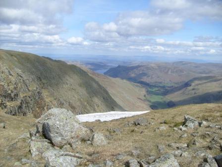
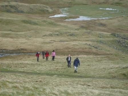
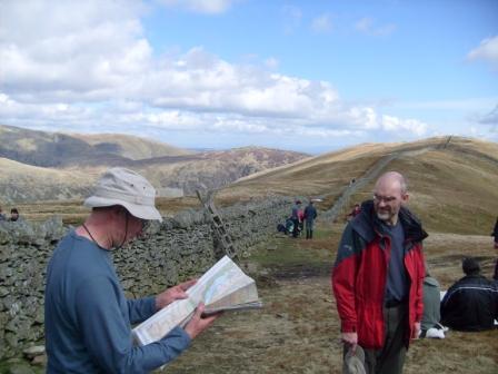
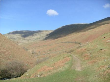
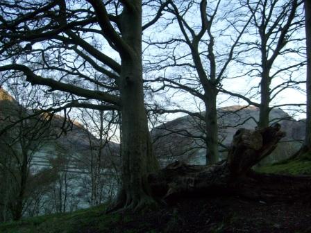
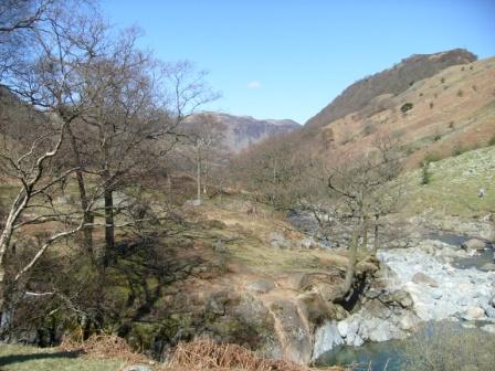
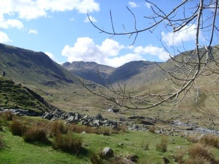
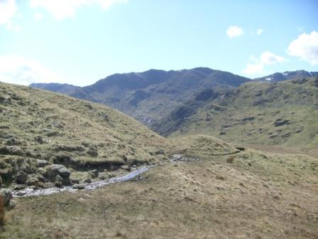
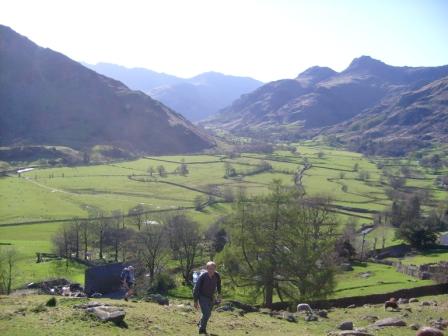
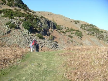
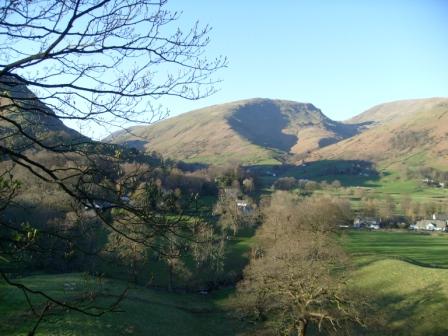
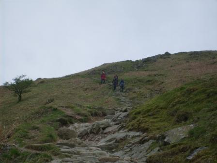
Easter Saturday: Mountains and Ullswater and snow.
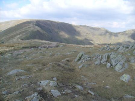
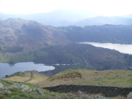
Going up to Dolly Wagon Pike on the way to Helvellyn.
The following pictures cover only some aspects of our activities. Since the emphasis was on the walking and not photography, please make allowances for the technical and artistic imperfections! However, before we get to the pictures, let's have a quick look at all the things we got up to. As you see, I have arranged these in time order.
- Maunday Thursday - We Arrive!. [Link] Early birds had already got in a walk on the hills east of Grasmere. The rest of us had a chance to play the tourist and nose around Grasmere. Rain welcomed us, but it would clear the next day.
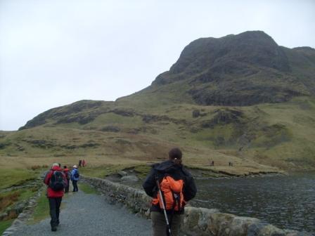
- Good Friday - Old Dungeon Ghyll. [Link] This was Gavin's nice introductory walk to the "pub at the end of the universe" and back. The descent to the pub was a typical lakeland walk (a melange of rocks and water) enjoyed by many walkers with their four-legged friends, not just by us. The weather was already showing a glimmering of summer. There was hope that we would actually see the Lake District in sunshine - exposed as Nature intended!
- Easter Saturday - Patterdale & Helvellyn (950m). [Link] The sunshine was here and we enyoyed JohnB's walk up one of the Lake Districts's highest mountains. Excellent weather. Excellent scenery. A memorable walk John!
- Easter Sunday - Borrowdale to Grasmere. [Link] This was a sunny walk from Rosthwaite, through Borrowdale, down to the "pub at the end of the universe" and back up over the hills to Grasmere. Another of JohnB's fine walks.
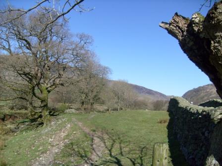
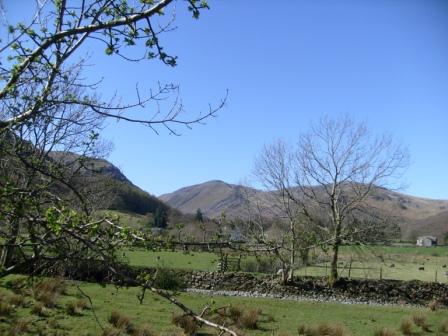
- Easter Monday - Fairfield Horseshoe (873m max). [Link] One of Ralph's great walks. There were four of us and we thoroughly enjoyed it. We had excellent views of the Lake District all round.
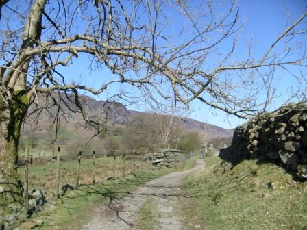
- Day 5 - April 14 Tuesday - Loughrigg (335m). [Link] This was an easy final jaunt up the local Loughrigg (no Irish connections) to round off a successful visit to the Lake District before our return to the deep south in the afternoon. Ralph, thanks for leading this walk with its nice views towards Grasmere and Windermere.
Now, enjoy your on-line visit to each day of our unforgettable experience of the Lake District!
Day 0 - April 09 Thursday - We arrive!
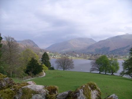
Early arrivers had already got in a walk on the hills east of Grasmere. The rest of us had a chance to nose arround Grasmere with its interesting old church of St Oswald, distinguished by its oak beam roof, its hatchments and monuments spotlighting the Grasmere of ages past. The churchyard contained Wordsworth's (1770-1850) grave together with those of his wife, descendants and many relatives. Wordsworth - now famous - seemed not to have been high enough up the social pecking order to have his monument in the church! Hosts of golden daffodils, mountains and a pleasant waft of gingerbread from the nearby Gingerbread Shop completed the scene. We wondered if Wordsworth would have appreciated what the tourist industry had made of his "Dove Cottage" on the way to Ambleside.
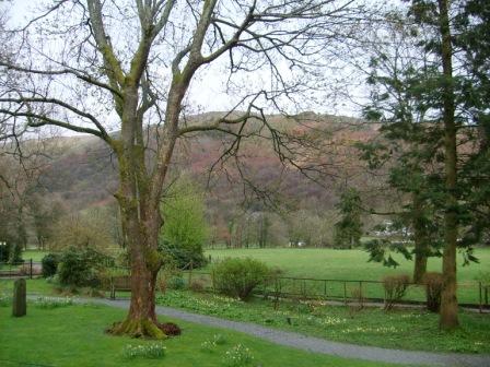
View from Wordsworth's Grave. - Note the obligatory daffodils, but importantly for us, the clouds are high enough so we can see the hill tops. A good omen for the days to come!
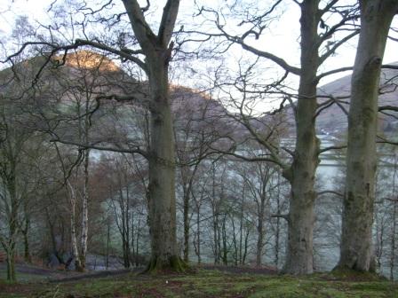
The YHA was a stone's throw from down-town Grasmere. The building, on a slope facing the hills to the east of Grasmere, looked as if it had been the home of a Victorian industrialist who had made good in the harsh social conditions of the time. The hostel, with its grand staircase and lounge, was in the last stages of renovation (just making Easter on time), but importantly, sold some exquisite wheat beers from the local north cumbrian Heskwith Brewery.
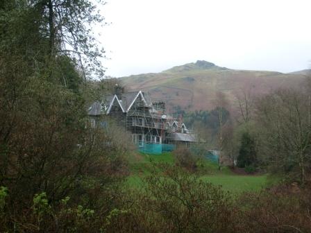
This is where we were staying - Butharlyp Howe YHA. Newly painted together with the more relaxed house regime that characterises the YHAs of the new era. Just open in time for Easter as the scaffolding suggests.
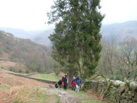
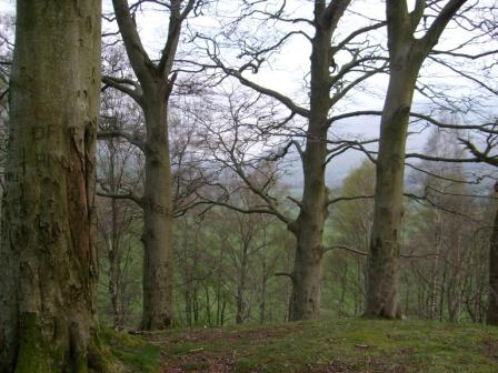
Day 1 - Good Friday - Grasmere Common & Dungeon Ghyll
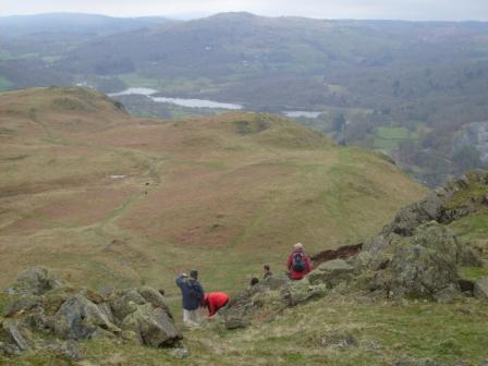
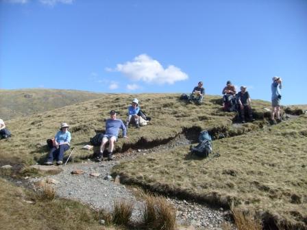
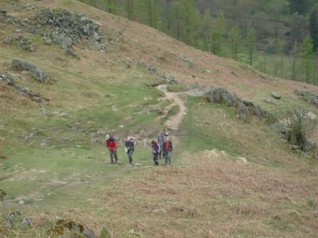
This was a nice introductory (warm up) walk to the "pub at the end of the universe" and back. There were nine of us and not one iota of trotter trouble - a good omen! The weather was already showing a glimmering of summer - there was hope that we would actually see the Lake District in sunshine. We reached a maximum height of about 400m.
Up to Grasmere Common as Grasmere (the lake or water that is) hoves into view.
Ever onwards and upwards.
Looking northwards. We make progress through the Lakeland landscape. The clouds are still there. Will they burn off?
This looks nice. The sun is reflecting in Grasmere and Rydal Water as a cloggie hoves into view.
We boldly step (southwards) where no cloggie has stepped before.
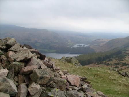
View past a wee cairn towards Grasmere and Rydal Water. Lakeland scenery with a vengeance!
A few moments "rejuvenation" with Grasmere (water/lake) in the distance.
View from the same cairn, looking west - that's where we are going.
Meercats or Cloggies?
Ever onwards and upwards.
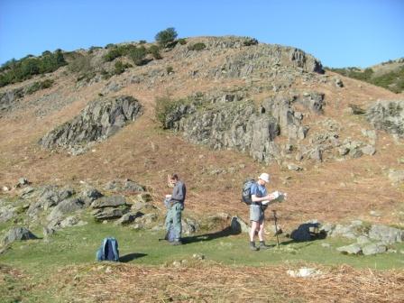
Left: "Yup. This is the way according to the OS".
Right: "I can look forward to complete confidence in our leader!"
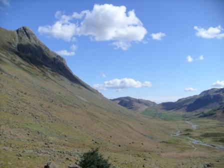
Stickle Tarn and Langdale Pikes.
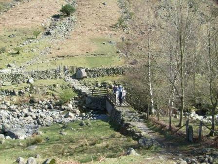
The descent to the pub from from Stickle Tarn along the furiously raging Stickle Gyll was a typical lakeland walk enjoyed by many walkers with their four-legged friends, not just by us. What a joy to hear the slate crunching under our feet as we crossed the raging torrent and bounced down the steep and rocky descent - even though the OS map seemed to have put the path on the wrong side of the Ghyll!
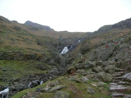
The way down to the Pub at the End of the Universe - Old Dungeon Ghyll. We rejoice in the sound of the waterfall and the ranging torrent from Stickle Tarn. We take pleasure in the sound of the rocks crunching beneath our feet. The stuff the Lake District is made of!
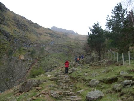
The advance party is coming down the mountain.
Great Langdale and Lingmoor Fell hove into view.
Suitably refreshed at the Old Dungeon Ghyll, we make our way back to Grasmere.
This is a final briefing, folks.
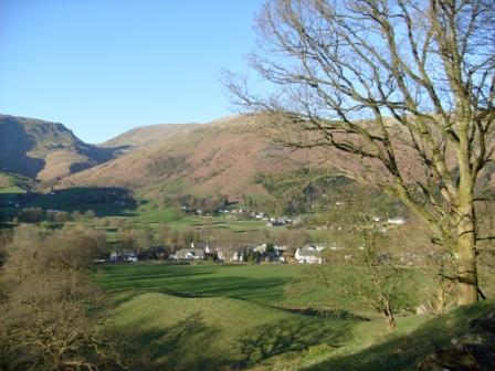
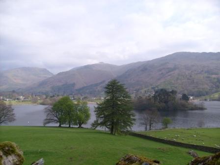
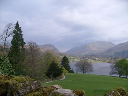
Returning to Grasmere (village) past Grasmere (lake). What a nice introduction, but we are still hoping for the sun to shine benignly on our Easter exploits.
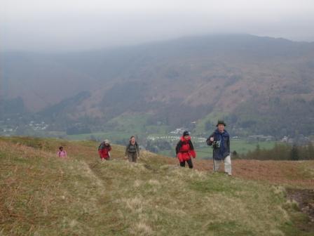
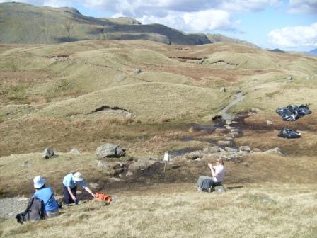
Day 2 - April 11 Easter Saturday - Patterdale & Helvellyn
The weather changed. The sun was here at last! What a lovely scenic morning bus journey over the Kirkstone pass (watershed) from Windermere into Patterdale! We then - as a group of seven - had a nice ascent of about 0.9 km, generating a healthy perspiration to wear off those beer calories - not really too much sweat! Helvellyn weighs in at 950m.
"That's the way we are going" points he, as we look back at the (short) way we have come from Patterdale.
St Sunday Crag is on the left and Dollywaggon and Nethermost Pikes are in the background. (Thanks JohnB!) Helvellyn is out of sight on the right - waiting for us.
We have reached the "Hole in the Wall" having come up from the right. Some perspiration, yes, but proverbially good exercise to wear off those accumulated beer calories.
"Yes, that's the way we are going", although there is bit of a quizzical look there.
"Thar be snow in them thar mountains" as seen from the "Hole in the Wall".
Another look at the (calorie burn off) way we came up from Patterdale - rocky steps and more rocky steps (what do you expect in the Lake District?).
After the Hole in the Wall, four of us (JohnE, JohnB, Paul and Ralph) make the final approach to Helvellyn along the Striding Edge - one false step and you kiss your extremity good-bye, if you have time! The other three of us (Gavin, Mark and I) enjoyed the more leisurely rock scramble afforded by the Swirral Edge on the other side of the Red Tarn - which didn't look all that red.
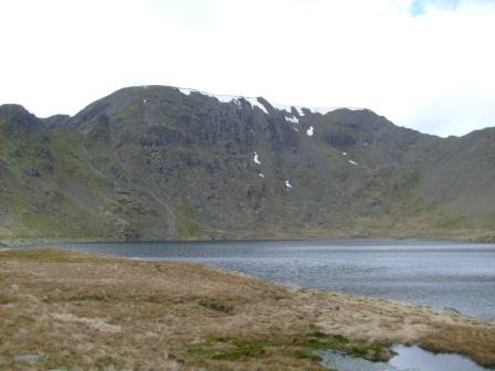
Snowy Helvellyn beckons across the Red Tarn, and looks with interest at the Lowry figures slowly moving along the Striding Edge (ridge to the left of the picture, Lowry figures thereon are clearly discernable in the original 7.2 MP picture).
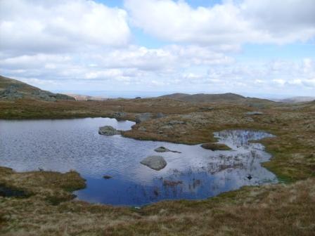
A tranquil high level pool busily reflecting the sunlight on the south side of the Red Tarn.
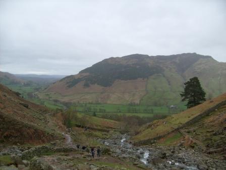
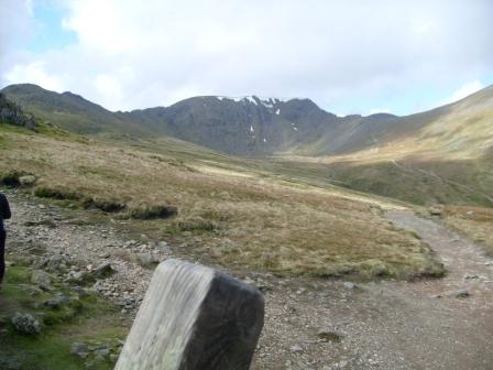
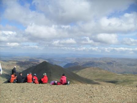
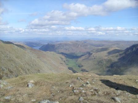
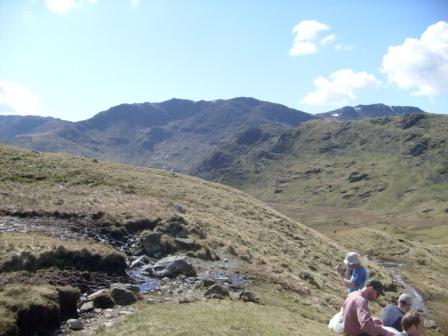
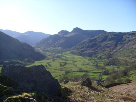
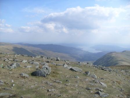
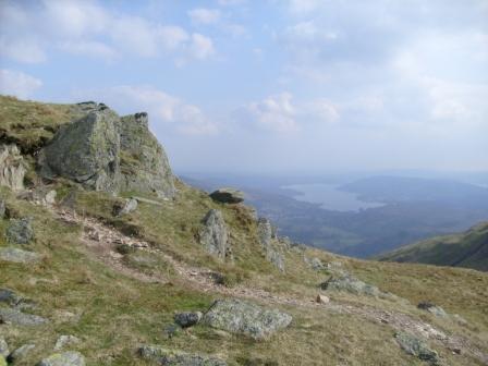
On top, there were lovely views all round of all the important lakeland peaks including Scafell Pike and Great Gable. Well worth the ascent from Patterdale! A gentle descent over Dollywagon Pike and past Grisedale Tarn brought us to the "Traveller's Rest" on the outskirts of Grasmere.
We are on top - Swirral (Edge) scramble no agro.

Time to admire the view, although those snow fields look a bit steep for a satisfactory, energy-dissipating, snowball skirmish.
Time to compare Swirral and Striding Edges.
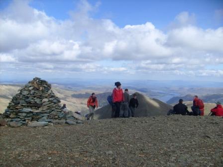
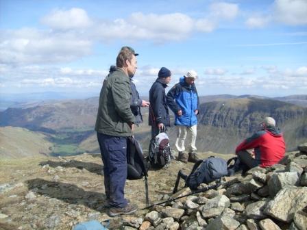
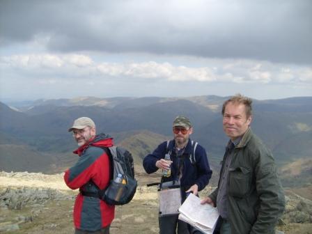
A group of Redcoats have also scaled Helvellyn.
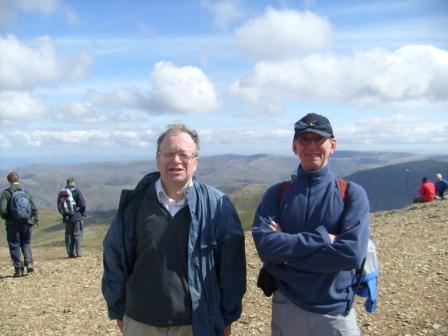
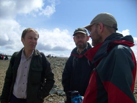
Paul in the shade and I trying to say "cheese".
Those Triangulation guys were here before us!
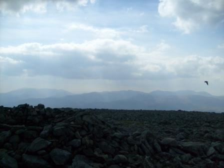
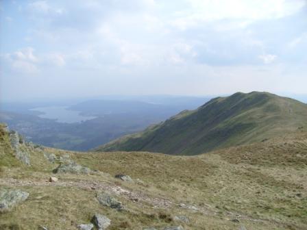
Mountains and Ullswater in the nude.
Mountains and Ullswater and I.
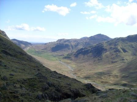
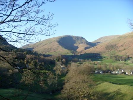
Mountains and Ullswater and snow. Going up to Dolly Wagon Pike.
Goodbye Dolly Wagon Pike. (JohnE is not wearing a hat).
Can't get enough of this - another view from Dolly Wagon Pike.
Yet another view from Dolly Wagon Pike.
Yes, very nice, but we need to get back to Grasmere before the close of the day.
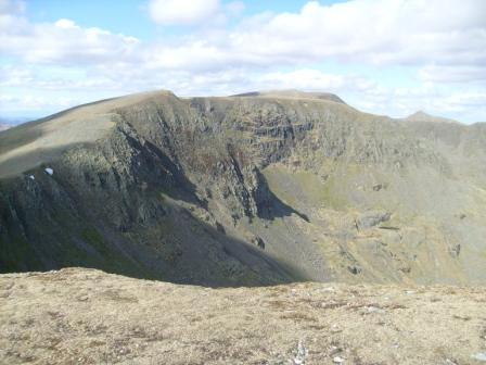
Looking back to Helvellyn - complete with Swirral and Striding Edges.
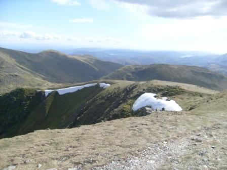
Easter snow lingers on at these altitudes.
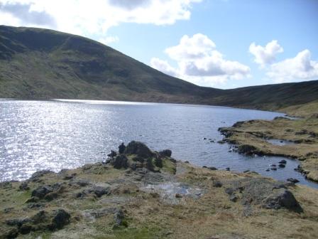
Tranquil Grisedale Tarn busily reflecting the sunlight.
Wending our way past Grisedale Tarn - is this the "Grand Canyon" of the Lakes?
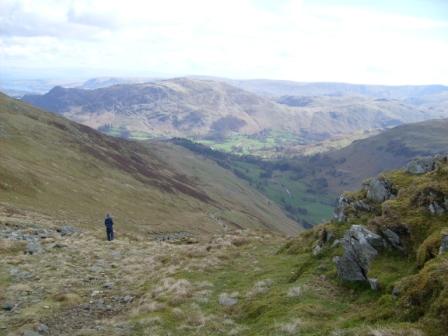
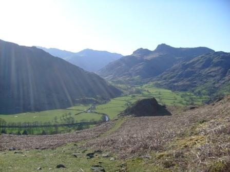
Not far to go now to the Traveller's Rest and Grasmere, as we look back on our gentle descent route. The sun has been shining brilliantly on our high-altitude exercursion today.
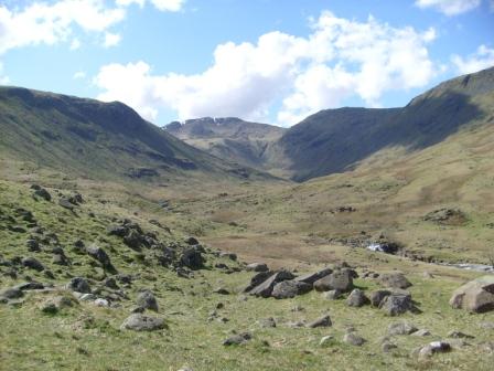
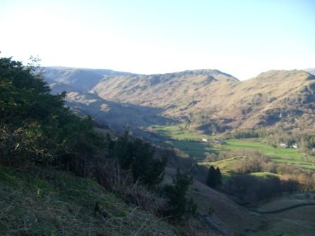
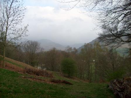
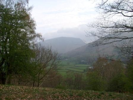
Day 3 - April 12 Easter Sunday - Borrowdale to Grasmere
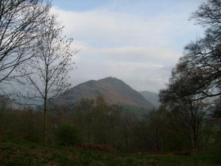
Before breakfast I went up the mound behind the hostel to enjoy the atmosphere created by the frosty fields in Easedale at the foot of Helm Crag. I couldn't resist this scenic beauty right on our doorstep - OK up a slippery, almost vanished path leading to the top of the Hostel's friendly neighbourhood mound. Our maximum height was about 500m.
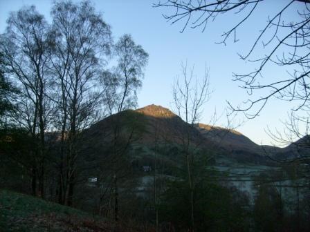
Helm Grag and Easedale. Sun and Frost. Nice but brrrh!">
More Sun on the ridge. Looks like another fine day.
Frosty fields in Easedale.
More frost.
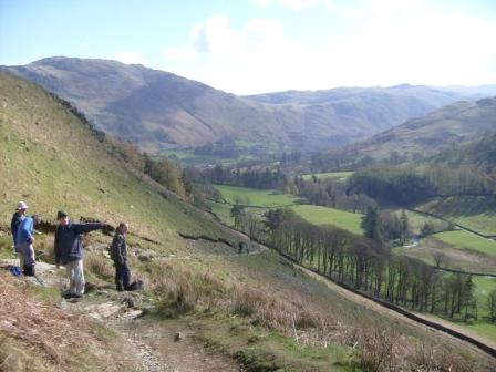
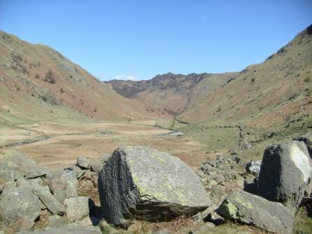
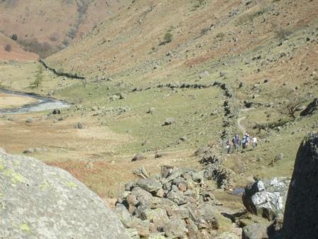
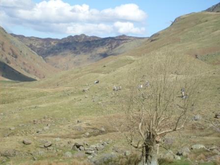
JohnB's walk started at Rosthwaite and took us through the peaceful Borrowdale valley along the Cumbria Way. Not a road, carpark or entrance fee in sight! Just the gurgling and rushing Langstrath Beck accompanied us we headed towards Stake Pass and the "Pile of Stones" along the Cumbrian Way.
Coming into Borrowdale from Rosthwaite.
The hills are alive with peace and tranquility.
Looking back the way we came.
The babbling (Stonethwaite) beck ferociously turns a corner (at Smithmire Island) where we cross over the bridge. All the water pouring out of those rain-soaked reservoirs higher up in the hills.
We cross the bridge and wait for a while to admire the scenery along Stonethwaite and Langstrath Becks - positioned at 90 degrees to each other.
How many years has this rock stood here? How many walkers have wondered at the forces of nature that may have shifted it from its erstwhile lofty position.
Looking back to the bridge - the way we came along Langstrath and its bubbling beck.
View from the "fortress".
We storm the "fortress".
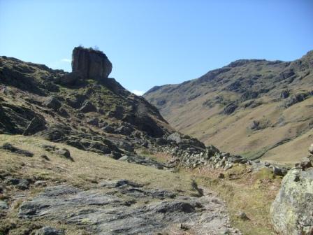
The "fortress" as built by the forces (farces?) of Nature.
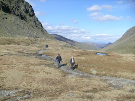
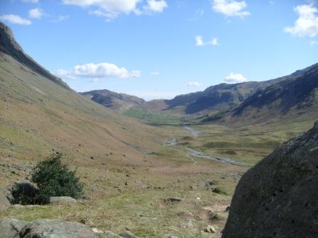
View down Langstrath from the hillock from where - in turn - we climb up to Stake Pass.
Stonethwaite Fell on the right and ahead of us, the part of Langstrath that we eschew because we want to get to the Old Dungeon Ghyll over Stake Pass.
Lunch Break before tackling Stake Pass - looking back the way we came up Langstrath.
Going up to Stake Pass, looking again at the "eschewed" part of Langstrath.
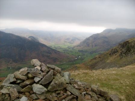
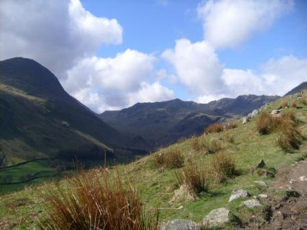
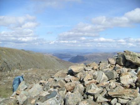
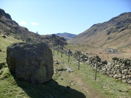
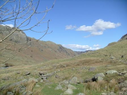
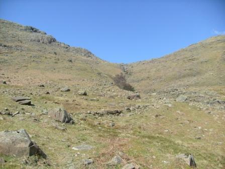
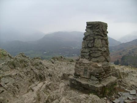
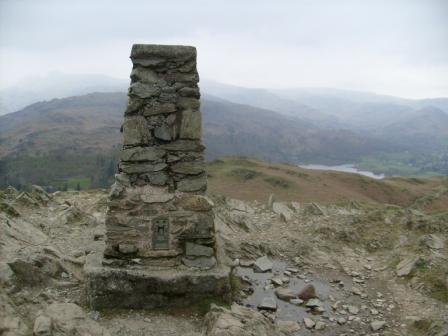
The "Pile of Stones" at about 500m marked the high point, and from there it was a gentle descent to the Pub at the End of the Universe which we had visited on Gavin's Good Friday walk. All the while, steep craggy rock faces and scree provided that essential Lakeland backcloth.
We get some rest at the "Pile of Stones" - our highest point of the day at about 500m.
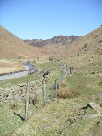
We look at the way we shall go - along the Mickelden Beck with the Langdale Fell to our left.
Still more rest at the "Pile of Stones".
We look back at the way we have come - over Stake Pass to the "Pile of Stones". Where was THE pile of stones, by the way?
Ready to make tracks?
We descend gently but "stonily" alongside the Mickelden Beck, with Langdale Fell to the left and Wrynose and Lingmoor Fells ahead.
We enter the valley leading to the Pub at the end of the Universe (Old Dungeon Ghyll) and admire the scree on our left (from the Langdale Pike) that has been building up over millenia.
Looking back up the Mickelden Valley that we have just descended.
Another view of the ancient Langdale scree.
The pub gave us the strength we needed for the last lap to Grasmere, for it was a tough climb over the top (about 400m) back to Butharlyp Howe, which we hit with great precision. However, the climb was worth the views we had of the mountains and dales bathed in the evening sun.
We start the climb to about 400m, with Old and New Dungeon Ghylls behind us.
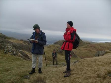
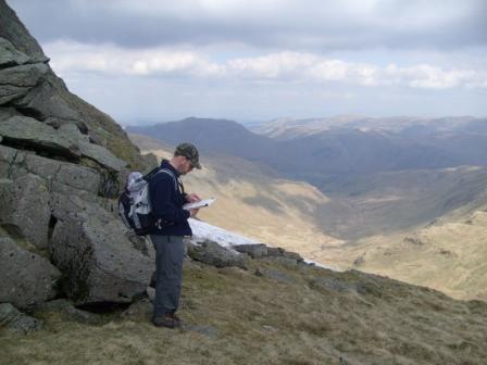
A moment's respite to check the route - the correspondance between the map and the actual terrain was not perfect, but JohnB did a great job to get us back to the hostel almost spot on.
Another view - this time higher up - of the Dungeon Ghylls.
Evening sunbeams grace our journey back over the top.
We are aiming for the slope on the right.
Hurrah! Easedale comes into view ...
... and so does Grasmere with the Great Rigg massif, leading to Helvellyn.
We get closer ...
... and closer ...
... and yet closer ...
... to Grasmere which is bathed picturesquely in the evening sun.
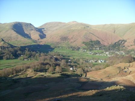
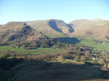
Day 4 - Easter Monday - Fairfield Horseshoe (873m max)
One of Ralph's great walks. There were four of us and we thoroughly enjoyed it. It was a rare opportunity, too good to miss! There was a gentle but continuous rise from Ambleside to the mountain top where the locals used to hold their fairs (hence Fairfield) in full view of all the important Lake District mountains. A perfectly manageable descent into Rydal with good timing for the return bus rounded off this sunny day.
We have come up from Ambleside and have reached Low Pike, with Windermere below us in the distance.
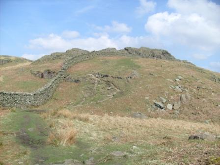
The Lake District's answer to the Great Wall of China? What the local farmers got up to in order to section off their respective sheep grazing territory! This wall could be hundreds of years old. Dry stone walls - no cement - not easy to knock down - very clever.
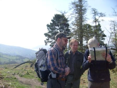
We check the map to ensure that we follow the ridge all the way to Fairfield.
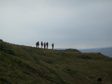
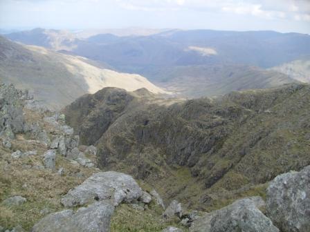
There are good mountain views in all directions.
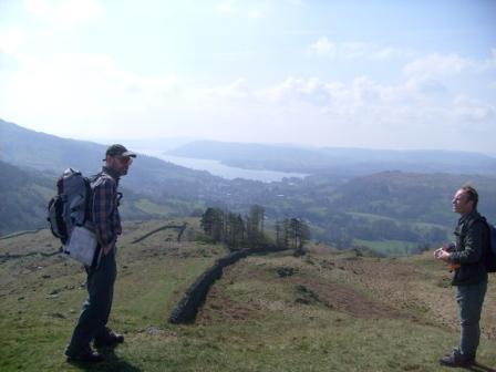
The Great Wall starts to look like the back of a Brontosaurus. Grasmere (the lake) lurks in the valley below.
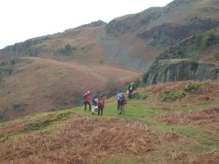
We march on to High Pike and Dove Crag ...
... but not before we savour the view steadily getting more magnificent behind us.
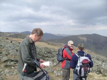
Another check of the map, but we are on the right track.
We have come up to Hart Crag ...
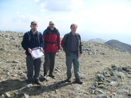
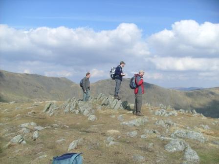
... and pose for a piccy - to show we were here!
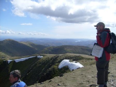
Still some snow around, as the names of the surrounding peaks are checked on the map.
We have lunch high above a steep and deep ravine shortly before reaching Fairfield.
And here is the ravine again.
We have reached Fairfield ...
... which is quite flat on top, hence the attraction for holding fairs. Equidistant from many dale-based villages no doubt, but the effort in carting - no, using horseback and "donkey-back" - all the stuff up for each fair and festivity, must have taxed the stamina of the local inhabitants over the centuries. A corvine (crow or rook - I can never tell them apart) flies around in the background - the only non-human living being in sight. What on earth does it live on?
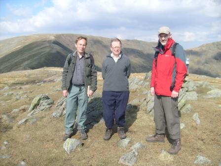
Yours truely up and at it on Fairfield, but not saying "cheese" this time.
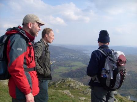
75% of the party on Fairfield, taken by the other 0.25% (myself).
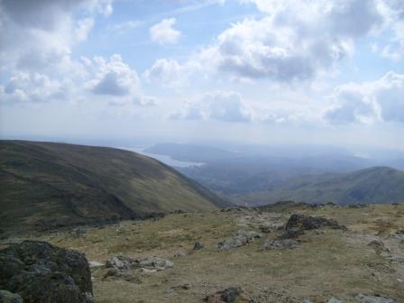
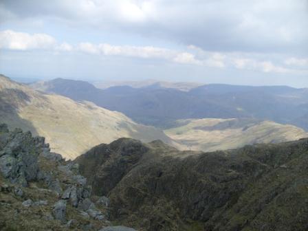
Viewing the way ahead from Fairfield.
What a lovely view! Our mutual friend - Lake Windy - is sprawled out in the distance. We are heading for the geological "hump"- Heron Pike - ahead.
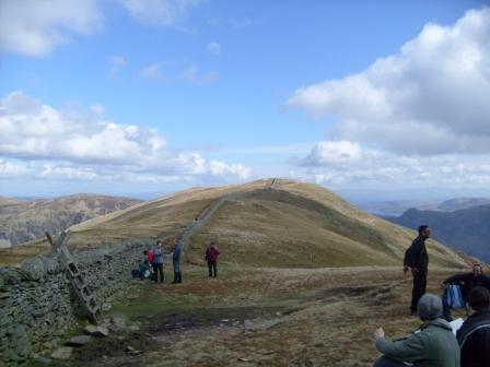
75% of our party on Great Rigg.
On Great Rigg, looking southish towards Lake Windy.
On Great Rigg, looking back to Fairfield.
On the way from Great Rigg to Heron Pike.
A bit further on the way from Great Rigg to Heron Pike.
Looking back again to Fairfield at the curvy (top) end of the Horseshoe.
We get closer ...
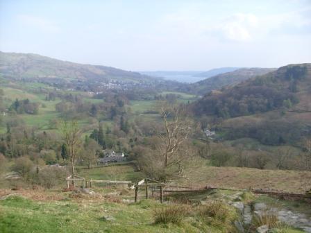
... and closer to Rydal.
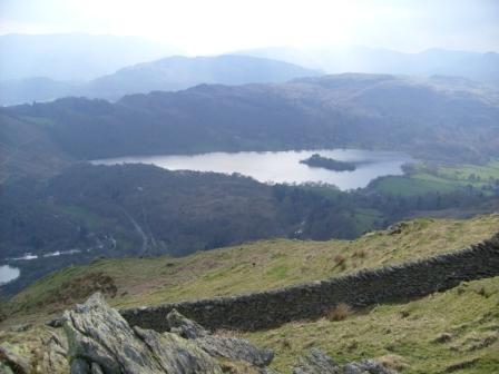
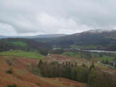
Grasmere (lake) in the late sun.
Rydal Water in the late sun.
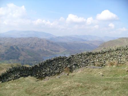
Grasmere and Rydal Water.
Rydal Water and Lake Windy.
A last look at the view before the final descent.
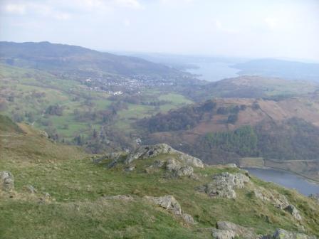
We are almost in Rydal - the other prong of the horseshoe, where we catch the bus one hour earlier than anticipated - for we made good progress without sacrificing our enjoyment of an excellent day. Thanks again Ralph for the fine walk!
Day 5 - April 14 Tuesday - Loughrigg (335m)
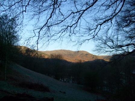
On the last morning, before breakfast, I again went up our friendly neighbourhood mound behind the hostel, in order to capture some more views of Easedale and Helm Crag. I often like to go for a walk before breakfast, after just a glass of water to detox, but otherwise without food. It stimulates a good natural hunger. The height of Loughrigg is 335m.
The morning has come and Nature has awoken.
Helm Crag in the mists. Rainy weather to come?
The cloud is lifting.
The cloud has lifted - at least so that the ridge clearly comes into view. Fairwell Easedale!
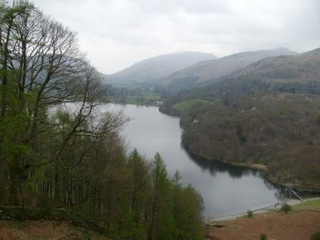
There was a final half day walk from Grasmere up the local Loughrigg hill (no Irish connections). Cloud and rain were begining to set in, but we still had good views towards Windermere and Grasmere. We couldn't really complain about the weather because we had had an excellent innings over Easter. It was a fitting way to round off a successful and action-packed Easter in the Lake District before our return to the deep south in the afternoon. Ralph, thanks for also leading this walk!
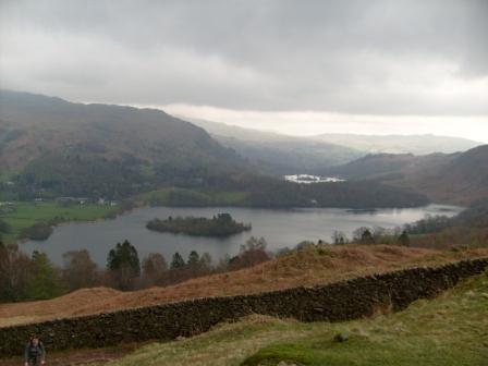
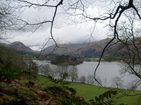
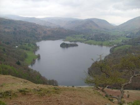
Sun, cloud and Grasmere (lake and village).
The island in the lake comes into view.
We leave the lake for Loughrigg.
We start our gentle climb to Loughrigg summit.
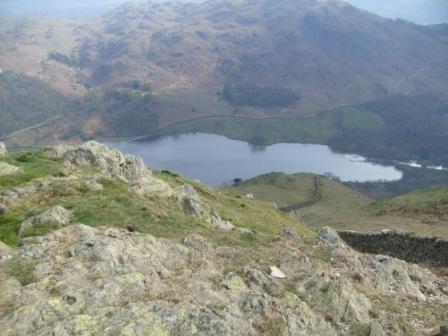
We look back over Grasmere (lake) as we climb Loughrigg.
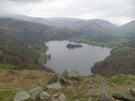
Higher we go, with Grasmere (lake) still behind us.
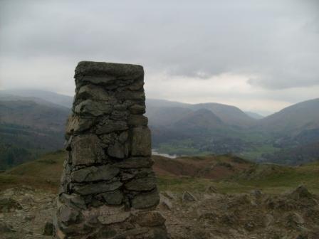
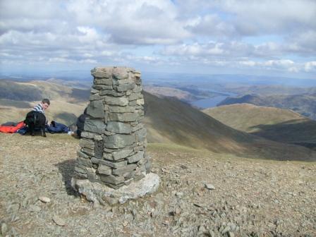
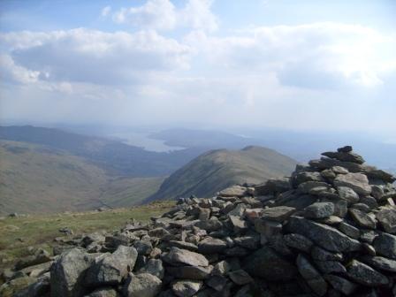
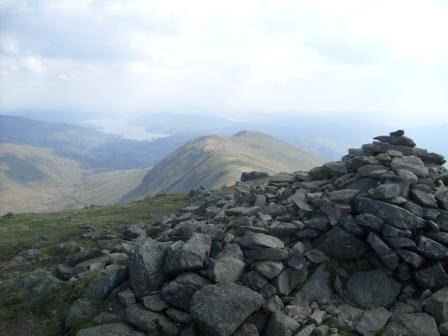
We have reached the triangulation point on Loughrigg summit, with Grasmere in the distance.
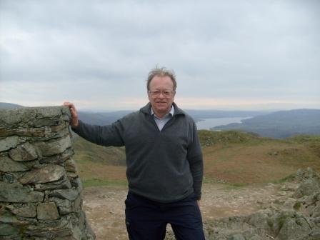
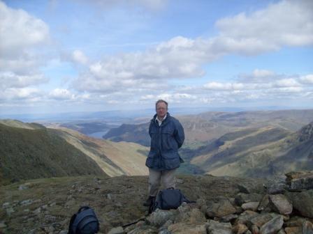
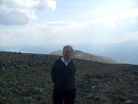
Yours truely with a seasoned expression at the summit.
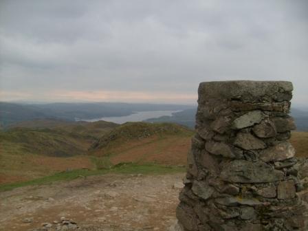
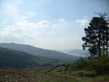
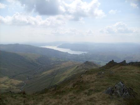
Loughrigg summit with our mutual friend, the Lake (not Lady) Windermere.
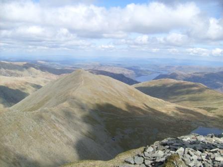
Loughrigg summit, looking towards Great Langdale.
Loughrigg summit and Grasmere.
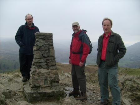
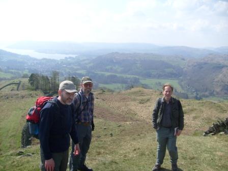
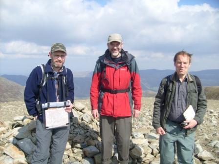
Our three heroes on Loughrigg summit.
Coming down from Loughrigg.
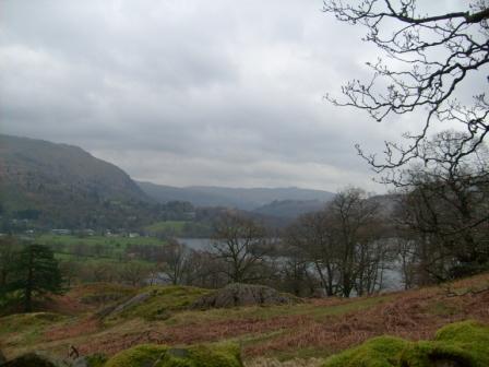
Grasmere (lake) in mists and reflections.
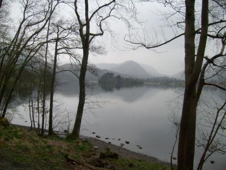
Reflections in Grasmere (lake) as we look towards Grasmere (village).
Our visit to the Lakes is drawing to a close.
Thank You Everyone!
Many Thanks to Gavin and all who organised and supported this year's CLOG sojourn in the Lakes. Many Thanks also to the walk leaders, including Gavin, JohnB, Ralph and Jane. A great time was had by all! We all look forward to more of the same - or at least very similar.
Eric Scharf
Original: 2017-03-03 @12:36
Updated: 2019-02-18 @17:46
SAGAX REX HANC RETIS ORBIS PAGINAM PINXIT ANNO MMXVII ET MMXIX.
© Eric Scharf