 |
HATFIELD PEVEREL to CHELMSFORD 2013 - May - 12 |
|
Hatfield Peverel to Chelmsford
- Introduction
- Cross Country to Danbury
- "The Anchor"
- Lingwood Common and Grace's Walk
- And so to Chelmsford
- Postscript
- Spoken Narrative.
This is a one minute audio presentation of our day walk. It should work with the three main browsers, but please click here if you would like more logistical details on this audio presentation.
- Contact, Copyright & "Readme"
Please click here for more general considerations relating to this page and other pages on this web site.
Introduction
This was one of Ralph's nice ex tempore walks, with some highly effective map reading and navigation on the way. Excellent Ralph - no undue hesitation or deviation! Essex is not completely flat. From the sleepy village of Hatfield Peverel we reached the Chelmer Navigation and then scaled the dizzy heights of the Danbury Plateau, which seems to be full of expensive houses hiding behind thick laurel hedges. Affluence rules OK. The oak-beamed Anchor pub was a welcome traditional lunch stop. Suitably regaled by the pub fare, we then enjoyed some more of the National Trust woodland, which makes Danbury such an attractive place to visit. The verdant splendor of Grace's Walk led us back down to the Chelmer Navigation, whose pretty locks form a picturesque gateway to Chelmsford City. Just beyond the historic cathedral, lies the well kept Victorian train station which was a fitting finale to a lovely walk. We had good weather with only a few drops of rain as we approached our destination. Ralph, Many Thanks!
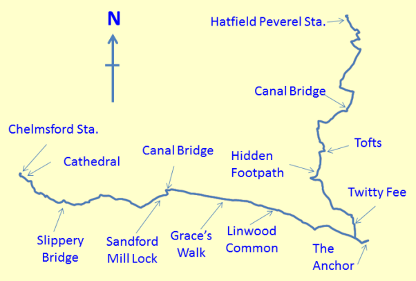
The walk of about 12.7 miles or 20.4 kilometres took in a pleasant part of the Chelmer Navigation as well as the wooded Danbury Plateau.
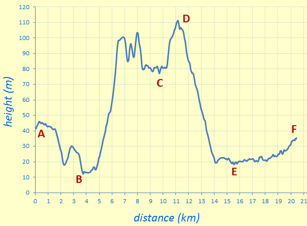
This height map of our walk makes Danbury appear like a fortress commanding the plains of Essex. "A" and "F" mark the train stations at either end of our walk. "B" and "E" are the first and second crossings of the Chelmer Navigation. "C" marks our lunch stop, "The Anchor" pub, and "D" marks the wooded National Trust land of Lingwood Common. The total height difference on our walk was about 100 metres. Sounds modest perhaps, but we certainly had good exercise with all the ups and downs! A lot of nice foot work.
Cross Country to Danbury
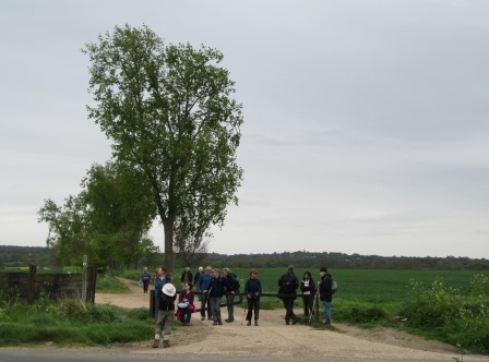
From the sleepy commuter village of Hatfield Peverel, with its traditional buildings and newer outskirts, we head across to the ever popular Chelmer Navigation. We follow it for a while, then leave the Sunday visitors behind by heading south towards Danbury, whose plateau we scale with reasonable ease. Danbury means lots of affluent dwellings hiding in among the National Trust woodland. An interesting street name attracts our attention. Web references regarding this singular name concentrate on the interesting property prices along this street, while offering the amateur historian - and the likes of us - no help regarding origins of the name itself. However,we are all now ready for lunch.
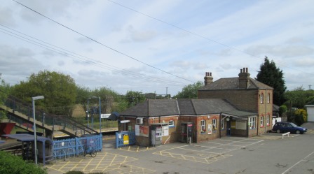
Hatfield Peverel: a small station on a busy main line. One train an hour. This former Great Eastern Station has a stationmaster's house - now private accomodation - and presumably had a goods yard. It used to be the main link with the outside world. For us it was the start to an enjoyable walk.
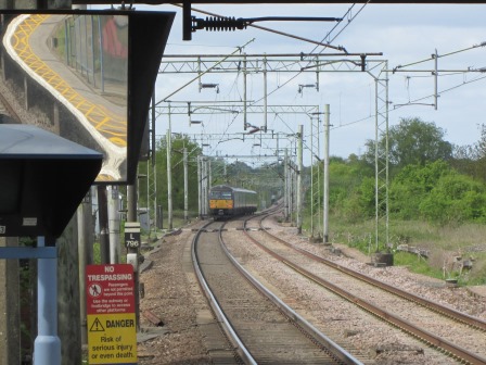
Present day railways seem to generate lots of clutter. Notice also the dip and rise in the track ahead of the London-bound train. Essex ain't that flat.
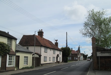
New housing estates have not ousted the more mature buildings in Hatfield Peverel.
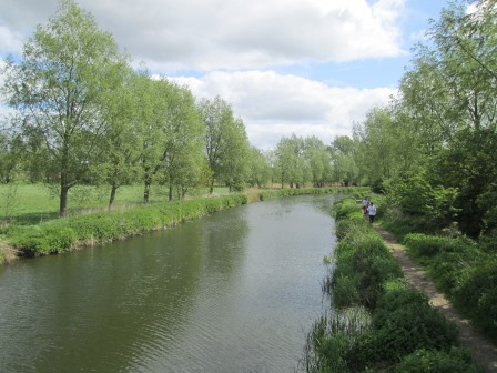
Soon we reach the Chelmer Navigation - all 14 miles completed by 1797 - linking Chelmsford to Maldon on the coast. The navigation was replaced by the railway, which was replaced in turn by road haulage. The navigation is now a tourism thing. Maldon to Chelmsford along the navigation is itself a relaxing - if flat - 15 mile walk (slightly longer than the original navigation). At 11 metres above sea level, this is the lowest point on our walk.
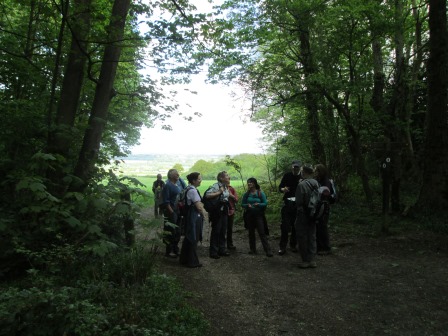
A short catch-my-breath and water break before we scale the Danbury heights.
It's a gentle rise to Tofts which is hosting an "Open garden" day. Not for us this time; for us, a more energetic agenda is on the cards.
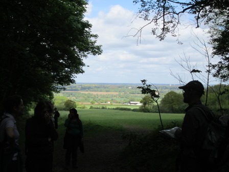
At the tip of Scrub Wood, we pause to admire the view back towards Hatfield Peverel ...
... and then there's time for a water-break.
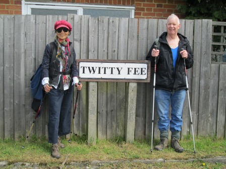
We proudly stand guard over our entry for the "Quirky Street Names of Essex" competition.
"The Anchor"
We spend a pleasant hour or so at "The Anchor", a 16th Century pub at the Eastern end of Danbury. The fare is good and price-wise quite reasonable. The pub even has a resident ghost, but sadly we did not have the opportunity to make his acquaintance.
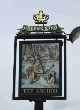
The inn sign suggests mermaids enjoying their swim around an anchor, apparently washed up on a sandy cove. Danbury didn't really seem the place for mermaids and sandy coves, but then some pub signs do allow the imagination to run riot, especially after a pint or two.
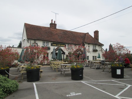
The pub was well frequented within, but some stalwart cloggies (on the right) hold the fort without.
Lingwood Common and Grace's Walk
Suitably regaled by our pub fare, we struck west to the wooded Lingwood Common, reaching about 110 metres above sea level - the highest part of our walk. Some distinguished looking properties later, we reached the tree-lined avenue Grace's Walk, which looked splendid in its spring-green mantle. And so began our gradual, descent to rejoin the Chelmer Navigation.
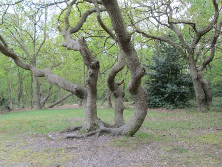
Lingwood common: looks like dancers wiggling their anatomies to music that sounds like they are suffering something horrible. Sorry folks, that's the probably unintended effect of some present day popular culture on me.
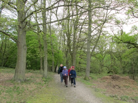
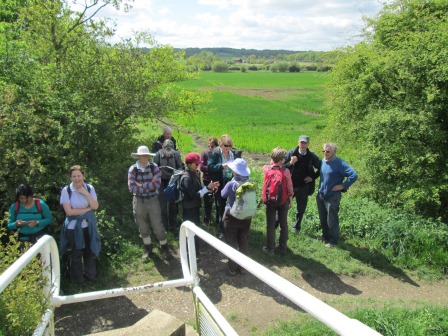
Onwards we go through Lingwood common until we come to a quondam view point. Quondam, because trees and shrubs like to grow, even if they block what must have been a nice view point.
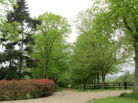
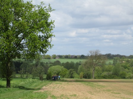
Here we come to Grace's walk, along the Admiral McHardy Way. If you want to find out what lies behind these names, you could do worse than taking a look at the Essex Walking web site. Indeed, this site could be the inspiration for further walks, so why not make a note of it? Back to our walk: you can see Northern Chelmsford in the right-hand distance.
We have come to the end of Grace's walk. If you look at the second Cloggie to your right, you can just about discern, above her head, the spire of Saint John, the historic parish church of Danbury. The church apparently marks the highest point in Essex, even if aided by the hand of man.
And so to Chelmsford
Several locks and an interesting slippery red bridge bring us to the outskirts of Chelmsford, which, of course, is now a city. The centre of the City still retains some of the traditional architectural fabric. The historic Cathedral is close to the railway station, which with its well kept historical flavour, is a fitting finale to our walk.
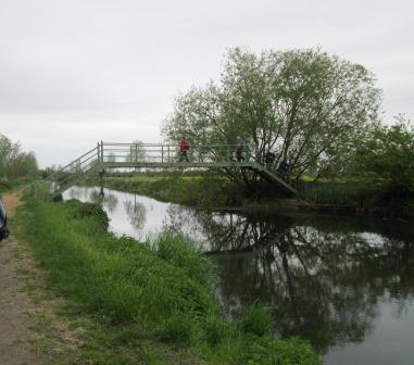
We cross the Chelmer Navigation again, and tell our ears that the A12 doesn't really exist. This spot is about 20 metres above sea level, because of the locks between here and our first crossing point of the Navigation.
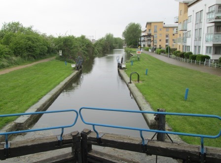
We come to the picturesque Sandford Mill Lock. It's starting to rain for the first time today. But it's only a few drops, and Cloggies are not made of sugar.
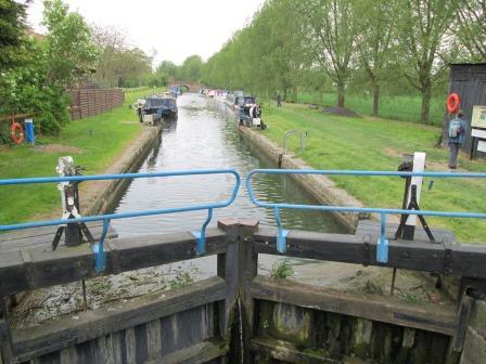
This is Allot Gardens Lock, a gateway to Chelmsford - City if you please!
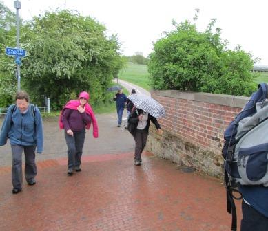
Just downstream from the lock is this bridge. A bridge that Health and Safety seems to have overlooked. I mean, even if those little red stone setts are even slightly wet, you don't have a walkway anymore - you have a slippery slide, as we found out. Health and Safety - cooee - are you listening?
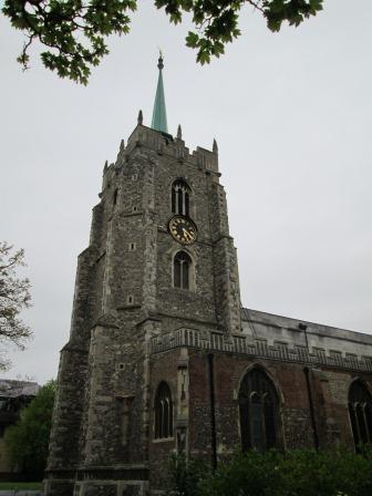
This is Chelmsford Cathedral - the railway station and the end of the walk are both nigh. The cathedral dates mainly from the 15th and 16th centuries and actually became a cathedral in 1914. It is the second smallest cathedral in the country - but whether "country" means England, Great Britain or the U.K. - or even the British Isles - is yet to be established by the learned articles on the web!
Postscript
Many thanks, Ralph, for an interesting walk full of scenic and historical impressions. Who says that Essex is as flat as the proverbial pancake? A good and pleasantly energetic day was had by all. In addition, for most of the time, the weather also played its part, even often allowing the sun to shine benignly on our bi-pedal endeavours. Perhaps we could revisit this walk in the autumn, and enjoy the rich colours this season bestows on our woodlands.
Eric Scharf
First Version: 2013-05-14 @16:48
Later Version: 2013-05-15 @12:43
Later Version: 2013-05-28 @19:35
SAGAX REX HANC RETIS ORBIS PAGINAM PINXIT ANNO MMXIII.