 |
South Downs HASSOCKS CIRCULAR 23rd June 2012 |
|
| Walk Preview Setting Off Foot of the Downs On the Downs Descent Thanks Maps Please Read Me |

A Bracing Day in South Downs Country
This was a relatively easy circular 14.5-mile walk based on Hassocks and taking in the historical Low Weald and the bracing South Downs. This was a CLOG walk and Nick led this excellent walk without undue hesitation or deviation - or even repetition! The sun frequently shone on our expedition, although the occasional clouds and the spell of rain in the afternoon were welcome in that they cooled things off a bit.
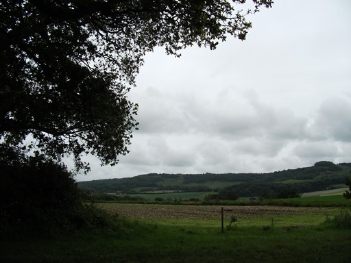
The steep descent from the windmills offers a wide panorama towards the north west and the North Downs. At the foot of the descent, lies Clayton with its Anglo-Saxon church complete with wall paintings. No doubt, worth a visit the next time we come to this part of the world.
Oldland, Ditchling, Streat and East Chiltington echoed in succession to the sound of our footsteps. Plumpton Racecourse greeted us just before we reached East Chiltington, although racing was not scheduled for the day.
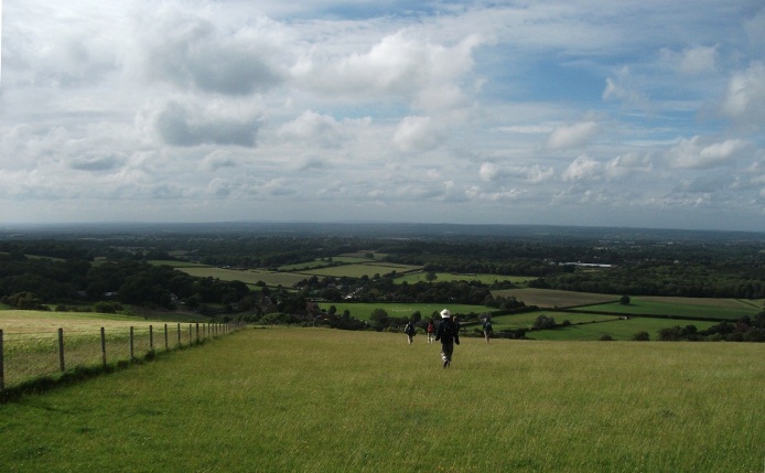
After lunch we took one of the many drovers' tracks that lead on to the Downs. From East Chiltington at about 34 m, we climbed up to Blackcap at 206 m. Thence it was a bracing ridge walk along the South Downs way, over Ditchling Beacon at 248 m, and on to the Jack and Jill Windmills. Good views all the way. Then it was back down to Hassocks via the ornate portal that graces the northern entrance to the Clayton railway tunnel.
A Quick Preview
Here is a quick preview of what's coming up. We also have a short audio presentation for you! It's all laid on for your delectation!
- Setting off
- At the Foot of the Downs
- On the Downs
- Descent to Hassocks
- Thank You
- Spoken Narrative.
This is a 1.5-minute audio presentation of our day walk. It should work with the three main browsers, but please click here if you would like more logistical details on this audio presentation.
- Contact, Copyright & "Readme"
Please click here for more general considerations relating to this page and other pages on this web site.
Setting Off
Getting to Hassocks by train was quick and easy, with a respectable - not unduly early - start time from London. This allowed even me, as an Essex Man of many years' standing, to join the walk from the wilds of that part of the world.
However, before we actually started our walk, there was the little question of how Hassocks actually acquired its name. Well, the railway company - the precursor of the LBSCR - was looking for a name for its newly opened station. The two neighbouring villages - whose names will not be disclosed for reasons of discretion - could not decide on which of their respective names should grace the station nameboards. There was so much wrangling and discord that in the end the railway company said, "Hassocks to you both", and the rest is history. Before you think that the railway company used robust language in its dialogue with the two villages, it should be remembered that the term "hassock" derives from an Anglo-Saxon word for a field full of tussocks - and there were quite a few of those (fields that is) - in the vicinity.
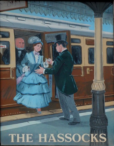
This is the sign gracing the outside of the pub close to the station. The sign, of course, celebrates the fact that the station name was courtesy of the original railway company. The train, with clerestory coaches in the LBSCR livery, has just arrived at Hassocks station. Out steps a lady - from a smoking compartment! She is falling into the embrace of, or being helped out by, her husband - or is it her suitor? Is she pleased to see him, or just relieved to have got out of the smoke in the compartment? Is that her chaperoning father behind? Has HE been smoking?
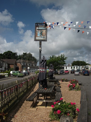
The inn sign was still bearing the awnings of the Diamond Jubilee. If you look carefully you can see three Carling Black Label "witches" guarding the trestle tables set up beneath the inn sign. Just over a year ago, on Sunday, 19th June 2011, on a previous visit to Hassocks (John E's walk from Hassocks to Lewes), I asked the publican what the origin of the inn sign advertising his pub was. Came the paraphrased reply: "Err, well, I ain't got a clue. I'm only the publican here.". I didn't have the heart to check if the intervening year had made him any the wiser!
Hassocks itself has quite a lot of historical charm, although our way out of town led past a new housing estate full of identical miniature (as regards cat swinging) semi-detached living units permanently scattered in seemingly random fashion and all roasting in the sun. Luckily, our actual walk would act as a liberator from such all too familiar manifestations of the modern age.
At the Foot of the Downs
We head out of town, headlong into five or six miles crammed full of scenic and historical impressions - the sort that imbed themselves into your memory as you begin to realise that there is more to the world than the stress and the ready-made glitzy imperfections of new-age living. The South Downs, up to which we shall eventually climb, accompany us all the way - "at arm's length" - for this first section from Hassocks to East Chiltington.

Just before we get to the Oldland post mill, we espy a garden, overgrown and untended, but exuding a delicious freshness in the warm sun. Colourful flowers cover the ground ...
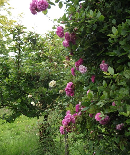
... and seem to climb up the bushes.
At the end of a tree-lined path there sits Oldland Windmill. (The garage and the blue hydraulic jack, for all their lack of a romantic flavour, insisted on being in the picture too.). Today the windmill is pointing towards the South Downs which we would later be traversing.
Being a post mill, of course, the whole structure above the base has to be turned bodily to point into the prevailing wind. The mill was built in 1703, dismantled in 1995, and is still being restored. Restored? Looks more like a complete rebuild!
From Oldland Windmill we have a good sideways view of that part of the South Downs whose ridge will form the second half of our walk.
Here is another view of the South Downs seen from a few yards further to the east.
This is the way to Ditchling, the South Downs always keeping us company on our right.
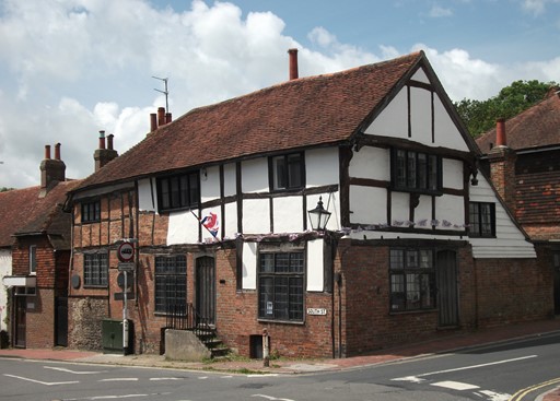
Downtown Ditchling. The Tudor building in South Street comes into its own during a short lull in the traffic at this otherwise very busy intersection. Ditchling exudes affluence at every pore.
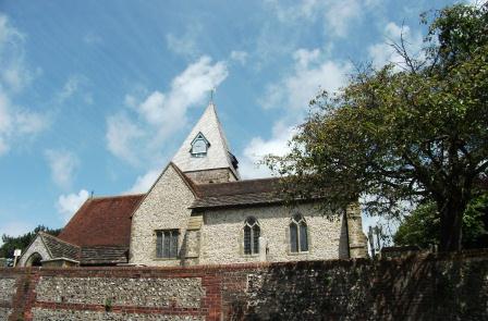
Nearby - on high in the centre of Ditchling - is St Margaret's parish church, dating from the late 12th century. The church's appearance is typical of the ancient churches hereabouts.
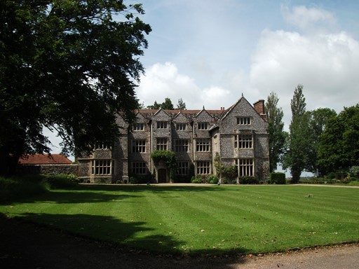
And so, to Streat. Streat Place is a magnificent grade II* listed building,
probably built between 1607 and 1627.
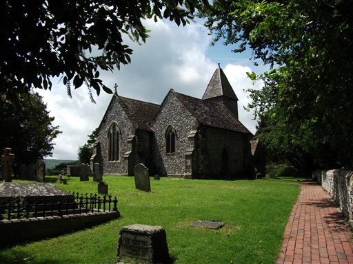
Churches were often sited next to the residence of the Lord of the Manor. In England, this juxtaposition typically formed the local axis of power in mediaeval and subsequent times, linking the spiritual and the temporal - the priest (or vicar) and the squire. The idea was that between them, these two gentlemen kept the locals in their respective stations. And so, it is in Streat, whose 11th century church - unusual in that it has no dedication - is just next door to Streat Place.
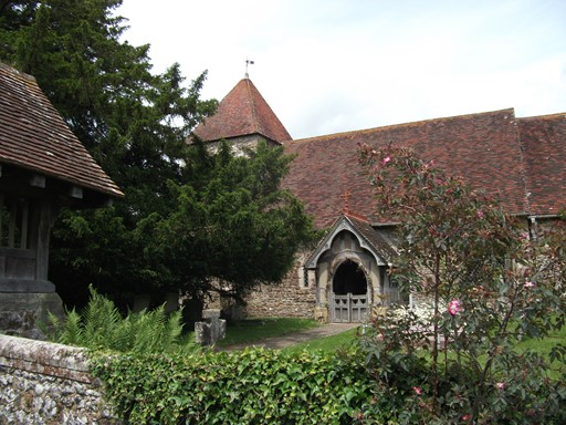
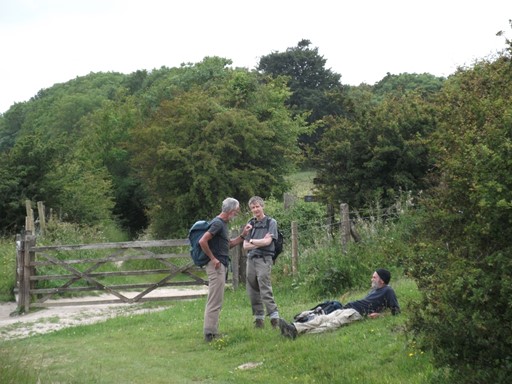
Onwards we step, past Plumpton Racecourse, to East Chiltington, with its 13th Century church.
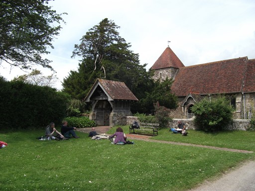
The lawn outside the church is a good place to have lunch before we go to the nearby Jolly Sportsman for a quick drink. They do a good cider at the pub - Black Rat; at 6% ABV it's advisable to stick to a half, considering the walk ahead. The pub is hosting a party whose focus of attention appears to be three kilted gentlemen (clans unknown) and a classic crimson MG from the days when such cars were made in England.
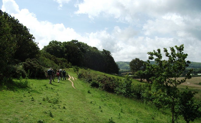
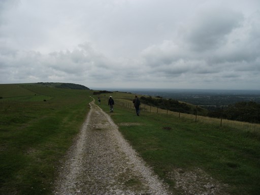
On the Downs
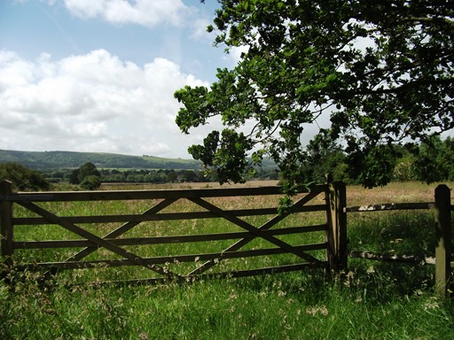
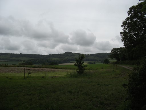
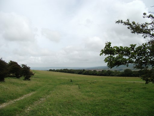
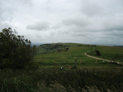
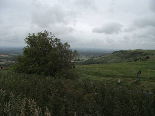
After lunch we take one of the old drovers' roads, along which cattle and sheep were taken to summer pasture on the Downs - a bit Alpine in a way. And so on to the Downs, which we reach after a moderately condensed climb of something approaching 0.2 Km. The five or six miles on top of the South Downs, along part of the South Downs Way, take us from Blackcap (206 m) via the site of the old Iron Age fort on Ditchling Beacon (good site hereabouts for a fort at 248 m) to the Jack and Jill windmills which stand guard over Clayton and the approaches to Hassocks.
As we head south along an old drovers' road, the Downs loom up ahead. This is looking roughly due south and ...
... this is looking - from the same spot - in a south easterly direction towards Lewes, beyond the dip in the Downs to the left.
We have scaled Blackcap ...
... take a short breather ...
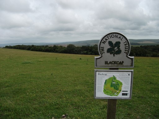
... and take note of the information generously provided by the National Trust. Lewes is somewhere in the distance on the left.
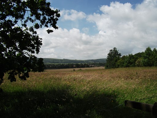
From Blackcap we can also look north over the Low Weald and ...
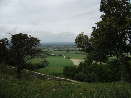
... the way that we have come in the morning past Plumpton Racecourse and through East Chiltington.
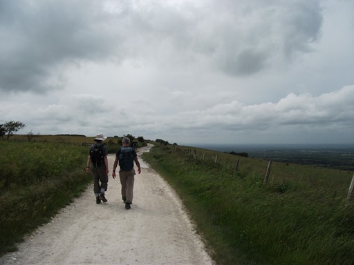
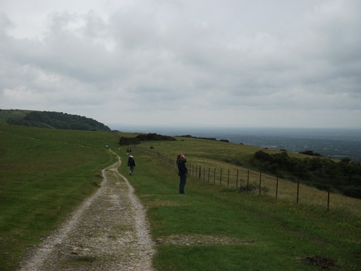
We stay on the ridge and the clouds are welcome for they are cooling us off.
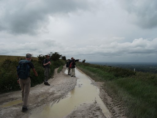
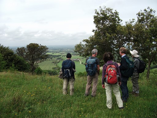
Nick points out some items of interest to the North, including the North Downs. The puddles are a left over from some earlier rain, rain which avoided us - or is it the other way?
Looking back the way that we have come.
Looking forward along the way we are about to take.
Nick has found something interesting - useful those binoculars.
We look towards Ditchling Beacon.
We look back from Ditchling Beacon.
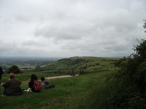
We stop for ice creams (one each) on Ditchling Beacon. What would the occupants of the erstwhile Iron Age fort here, have made and thought of ice cream?
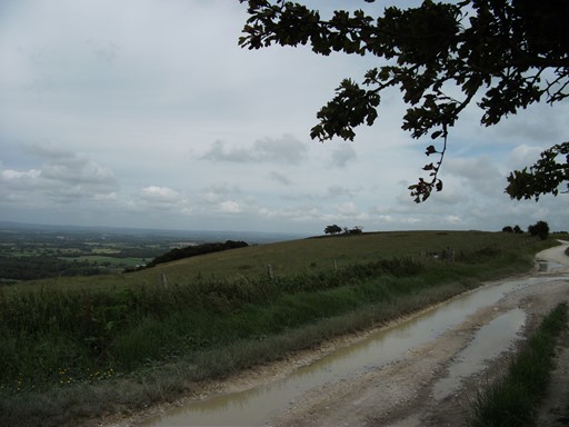
Descent to Hassocks
Windmills and a railway tunnel are salient features on our last leg to Hassocks, which we reach exactly in time to catch the 18:17 as noted in Nick's introductory description of the walk. Perfect timing! We have completed the "circle" without (as stated above) hesitation or deviation!
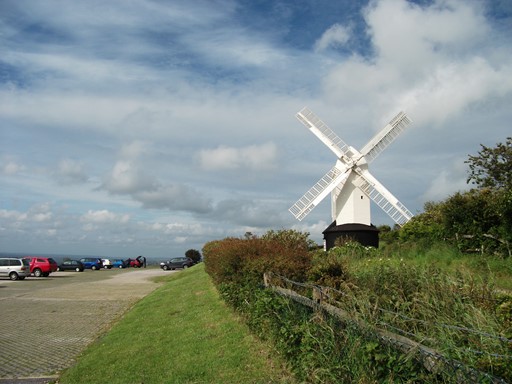
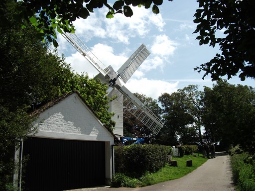
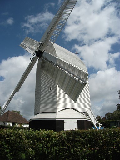
Jill is a post mill built in 1821, and, as you would expect,
has a commanding position on the South Downs.
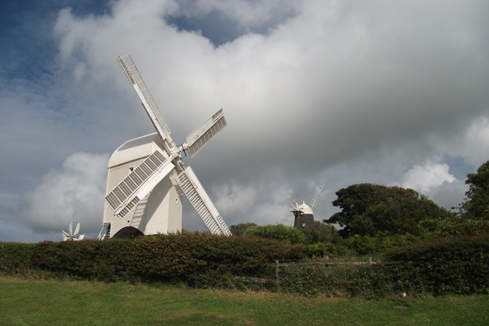
Jack, in the background and minus a sail or two, keeps Jill company, and is a five-storey tower mill built in 1866 to replace Duncton Mill. Apparently, the latter's base is still in position next to Jack. To turn Jack into the wind it is only necessary to turn Jack's domed cap, whereas for a post mill, such as Jill, the whole body has to be turned into the wind. All three mills (even the Duncton stump) are grade II* listed.
The steep descent from the windmills offers a wide panorama towards the north west and the North Downs. At the foot of the descent, lies Clayton with its Anglo-Saxon church complete with wall paintings. No doubt, worth a visit the next time we come to this part of the world.
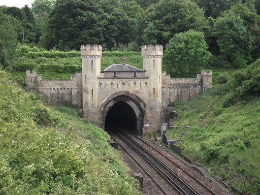
Up to 1841, Hassocks was the rail terminus if you wanted to reach Brighton from London. Onward travel by horse drawn coach using a devious route was required. The railway company bit the bullet and completed the two-kilometre-long Clayton tunnel in 1841 after three years' hard slog. Uncertainty rules OK, for there are three unsubstantiated possibilities as to why this grade II northern portal was built: (1) to act as a monument to the tunnel builders, (2) to reassure nervous passengers, (3) to satisfy the local landowner. Tunnel cottage, today in private hands, graces the top of the portal and was built in 1849 for the tunnel keeper. He had to ensure that the tunnel gas lights were relit as soon as a passing steam train extinguished them. And the gas lights were needed in the tunnel to reassure the passengers who would otherwise have had to travel through the tunnel in complete darkness. So there!
Thank You
Many Thanks Nick, for leading this invigorating walk and Many Thanks to all who came to support it and provided good company. The walk was an excellent blend of lowland history and upland panoramics. A great time was had by all and of course, we all look forward to more of the same - or at least very similar.
Eric Scharf
Original Issue: 2012-06-29 @15:24
Latest Update: 2013-01-10 @13:08
Latest Update: 2020-06-18 @17:37
SAGAX REX HANC RETIS ORBIS PAGINAM PINXIT ANNO MMXII ET MMXX.